Old Kilpatrick
Old Kilpatrick
|
|
|---|---|
 Old Kilpatrick and the Kilpatrick Hills, seen across the Forth and Clyde Canal |
|
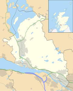
| Old Kilpatrick shown within West Dunbartonshire | |
| OS grid reference | NS463729 |
| Council area | |
| Lieutenancy area | |
| Country | Scotland |
| Sovereign state | United Kingdom |
| Post town | Glasgow |
| Postcode district | G60 |
| Police | Scottish |
| Fire | Scottish |
| Ambulance | Scottish |
| EU Parliament | Scotland |
| UK Parliament | |
| Scottish Parliament | |
Old Kilpatrick (Scots: Auld Kilpaitrick, Scottish Gaelic: Cille Phàdraig meaning "Patrick's church", [ˈkʰʲiʎəˈfaːt̪ɾɪkʲ]), is a village in West Dunbartonshire, Scotland.
The village is on the north bank of the River Clyde immediately to the north of the Forth and Clyde Canal, 3 miles (5 km) from Clydebank on the road to Dumbarton. The Great Western Road runs through Old Kilpatrick, and the next village to its west is Bowling. The modern A82 trunk road runs to the north of Old Kilpatrick, between the village and the foot of the Kilpatrick Hills. There is a legend that it was the birthplace of Saint Patrick.
The western end of the Antonine Wall was at Old Kilpatrick (the eastern end, 59 km distant was at Bridgeness, to the east of Bo'ness on the Firth of Forth). The physical traces of the wall have been erased but the route was surveyed during the 18th century and traced to the Chapel Hill where various Roman artefacts were found.
When the Forth and Clyde Canal was being dug in 1790 the remains of a bathhouse were discovered. In 1913 the foundations of the fort which had been conjectured as being in the vicinity were confirmed. In 1923 during redevelopment of the area significant archaeology was undertaken, which established the size and nature of the fort. Established around 81 AD, it occupied an area of about four acres enclosed by an outer defensive wall. If the date is correct it shows that the fort preceded the Antonine Wall by some sixty years. Internally, buildings discovered included a praetorium (headquarters), barracks and a granary. Major development precluded further significant excavation, and nothing is visible of the remains today; the remains lie beneath the houses of Gavinburn Gardens to the east, a large commercial building to the west and the A814 road to the north.
...
Wikipedia

