Olathe Air Force Station
| Olathe Air Force Station | |
|---|---|
| Part of Air Defense Command (ADC) | |
|
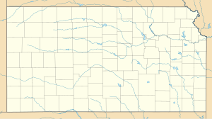
Location of Olathe AFS, Kansas
|
|
| Coordinates | 38°50′06″N 094°54′16″W / 38.83500°N 94.90444°WCoordinates: 38°50′06″N 094°54′16″W / 38.83500°N 94.90444°W |
| Type | Air Force Station |
| Code | ADC ID: P-72, NORAD ID: Z-72 |
| Site information | |
| Controlled by |
|
| Site history | |
| Built | 1951 |
| In use | 1951-1968 |
| Garrison information | |
| Garrison | 738th Aircraft Control and Warning (latr Radar) Squadron |
Olathe Air Force Station is a former United States Air Force radar station that was located in Gardner, Kansas. It was located next to Naval Air Station Olathe, now the grounds of New Century AirCenter.
In 1950 the United States Air Force Air Defense Command selected Olathe NAS as a site for one of twenty-eight radar stations built as part of the second segment of the permanent ADC general radar surveillance network for the United States. Prompted by the start of the Korean War, on July 11, 1950, the Secretary of the Air Force asked the Secretary of Defense for approval to expedite construction of the second segment of the permanent network. Olathe was to provide defense radar coverage of the Kansas City area.
Receiving the Defense Secretary’s approval on July 21, the Air Force directed the Army Corps of Engineers to proceed with construction of a radar station on the western part of the ground station, about a mile from the runway and ramp/hangars being used by the Navy. Additional housing units were also constructed at Olathe to accommodate the Air Force personnel. The Federalized Utah Air National Guard 130th Aircraft Control and Warning Squadron was assigned to the site on 1 June 1951 at the facilities of the 2472d Air Force Reserve Training Command, and initially the station functioned as a Ground control intercept (GCI) and warning station. As a GCI station, the squadron's role was to guide interceptor aircraft toward unidentified intruders picked up on the unit's radar scopes. It was relieved from active duty and returned to control of the State of Utah on 1 February 1953.
The Ground Air Transmitting Receiving (GATR) Site for communications was located at 38°50′27″N 094°54′19″W / 38.84083°N 94.90528°W, approximately 0.4 miles north from the main site. Normally the GATR site was connected by a pair of buried telephone cables, with a backup connection of dual telephone cables overhead. The Coordinate Data Transmitting Set (CDTS) (AN/FST-2) at the main site converted each radar return into a digital word which was transmitted by the GATR via microwave to the Control Center.
...
Wikipedia


