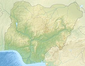
Okomu National Park
| Okomu National Park | |
|---|---|
|
IUCN category II (national park)
|
|
| Location |
Ovia South-West, Edo State, |
| Nearest city | Udo |
| Coordinates | 6°20′0″N 5°16′0″E / 6.33333°N 5.26667°ECoordinates: 6°20′0″N 5°16′0″E / 6.33333°N 5.26667°E |
| Area | 200 km² |
| Established | 1935 |
The Okomu National Park, formerly the Okomu Wildlife Sanctuary, is a forest block within the 1,082 km² Okomu Forest Reserve in the Ovia South-West Local Government Area of Edo State in Nigeria. The park is about 60 km north west of Benin City. The park holds a small fragment of the rich forest that once covered the region, and is the last habitat for many endangered species. It continues to shrink as villages encroach on it, and is now less than one third of its original size. Powerful corporations are involved in plantation development and logging concessions around the park, which also pose a threat.
The park holds a remnant of the Nigerian lowland forests that once formed a continuous 50–100 km wide belt from the Niger River west to the Dahomey Gap in Benin. To the south and southeast the forest was separated from the coast by mangrove and swamp forests, while to the north it merged into the Guinean Forest-Savanna Mosaic ecoregion. Human pressure is not new. In the Okomu park there is an extensive layer of charcoal and pottery below the forest, indicating that it was cleared and then regenerated over the last 700 years. By the start of the 20th century the forest survived only in disconnected blocks, which were under intense pressure from human activity. The British colonial administration set up a series of forest reserves to manage what remained, including controlled extraction of valuable trees such as African mahogany.
The 200 km² wildlife sanctuary, a rainforest ecosystem that is the habitat for many endangered species of flora and fauna, was gazetted from the Okomu Forest Reserve in 1935. A survey of southwestern forests in Nigeria in 1982 led to a recommendation for a determined effort to conserve the sanctuary. The state government formally defined the sanctuary in 1986, with an area of just 66 km2. The Nigerian Conservation Foundation (NCF) took over management of the sanctuary in 1987, and extended it to 114 km2 by adding a 1.6-kilometre-wide (1 mi) buffer zone.
The NCF was diverted into assisting migrant farmers in the surrounding areas, in an attempt to help the villagers find alternative means of living without encroaching on the forest. The NCF agricultural initiatives had the perverse effect of attracting immigrants from poorer areas, and thus increasing the pressure from illegal hunting and logging. In 1997 it was also found that several NCF employees had been involved in illegal logging within the sanctuary. In May 1999 the sanctuary was taken over by the National Park Service.
...
Wikipedia

