Ogle Airport
|
Eugene F. Correira International Airport Ogle |
|||||||||||
|---|---|---|---|---|---|---|---|---|---|---|---|
| Summary | |||||||||||
| Airport type | Public | ||||||||||
| Operator | Ogle Airport Inc. | ||||||||||
| Serves | Georgetown, Demerara-Mahaica, Guyana | ||||||||||
| Elevation AMSL | 10 ft / 3 m | ||||||||||
| Coordinates | 6°48′26″N 58°06′21″W / 6.80722°N 58.10583°WCoordinates: 6°48′26″N 58°06′21″W / 6.80722°N 58.10583°W | ||||||||||
| Website | ogleairportguyana.com | ||||||||||
| Map | |||||||||||
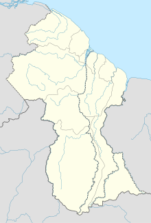
| Location of the airport in Guyana | |||||||||||
| Runways | |||||||||||
|
|||||||||||
|
Source: GCM Google Maps
|
|||||||||||
Eugene F. Correira International Airport (IATA: OGL, ICAO: SYEC) is located on the Atlantic Ocean coast of Guyana, 6 kilometres (3.7 mi) east of the capital, Georgetown, in the Demerara-Mahaica region of Guyana. In 2013 LIAT began operations out of Barbados at this airport switching over from the Cheddi Jagan International Airport.
The airport was formally known as Ogle International Airport.
In 2003 the airport was a local hub shuttling some 50,000 passengers and 1,800 tons of cargo annually. Construction began that year to expand the facility to an international airport with upgraded facilities for immigration, customs, air traffic control, health and fire service. The lengthened and expanded runway is now in service, and a ceremony to formally open the new airport terminal was held in March, 2007.
OGL received its port-of-entry certification in 2009. It has a Class 1A, 4,200 feet (1,300 m)-long runway made of concrete (07-25) the former runway 07R-25L is now being used as a taxiway only. It operates under Visual Flight Rules (VFR) and Instrument Flight Rules (IFR). The airport is a capable of handling smaller business jets as well as regional turboprop airliners such as the ATR-42 operated by Leeward Islands Air Transport (LIAT) and the Beechcraft 1900D flown by Trans Guyana Airways.
...
Wikipedia

