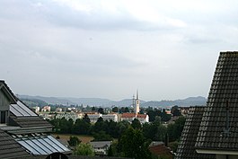
Oftringen
| Oftringen | ||
|---|---|---|
 |
||
|
||
| Coordinates: 47°19′N 7°55′E / 47.317°N 7.917°ECoordinates: 47°19′N 7°55′E / 47.317°N 7.917°E | ||
| Country | Switzerland | |
| Canton | Aargau | |
| District | Zofingen | |
| Area | ||
| • Total | 12.85 km2 (4.96 sq mi) | |
| Elevation | 419 m (1,375 ft) | |
| Population (Dec 2015) | ||
| • Total | 13,251 | |
| • Density | 1,000/km2 (2,700/sq mi) | |
| Postal code | 4665 | |
| SFOS number | 4280 | |
| Surrounded by | Aarburg, Dulliken (SO), Rothrist, Safenwil, Starrkirch-Wil (SO), Strengelbach, Walterswil (SO), Zofingen | |
| Twin towns | Filet (Switzerland) | |
| Website |
www SFSO statistics |
|
Oftringen is a municipality in the district of Zofingen in the canton of Aargau in Switzerland.
The earliest trace of human habitation near Oftringen is scattered mesolithic era finds. A Roman era farm at the intersection of two roads and scattered Alamanni settlements have also been found. The modern municipality of Oftringen is first mentioned in 924 as Ofteringa. The village was under the Herschaft of the Counts of Frohburg from the Middle Ages until 1299, when they came under Habsburg authority. Following the Bernese conquest of the Aargau in 1415 it belonged to the Amt or township of Aarburg. It remained part of Bern until 1798. Under the guidance of Bern, in 1528 the Protestant Reformation entered the village. In 1667 an ecclesiastical court was set up in the village. In 1663 the first schoolhouse was built, and in 1740 a second one was added in the hamlet of Küngoldingen. The district school was built in 1969-70.
It was part of the parish of Zofingen until 1920 when its own parish was formed. The parish church was built in 1933-34.
Since the expansion of Bernese road networks in the 18th Century the Bern-Zurich and Basel-Lucerne roads cross in Oftringen. In addition, since 1856 the town is on the Olten-Lucerne railway, though the station is located in Aarburg. The Aarau-Zofingen railway line was built in 1875-77 by the Swiss Federal Railways. In 1914 a station at Küngoldingen was added.
...
Wikipedia


