Oberlunkhofen
| Oberlunkhofen | ||
|---|---|---|
 |
||
|
||
| Coordinates: 47°19′N 8°23′E / 47.317°N 8.383°ECoordinates: 47°19′N 8°23′E / 47.317°N 8.383°E | ||
| Country | Switzerland | |
| Canton | Aargau | |
| District | Bremgarten | |
| Area | ||
| • Total | 3.25 km2 (1.25 sq mi) | |
| Elevation | 442 m (1,450 ft) | |
| Population (Dec 2015) | ||
| • Total | 1,925 | |
| • Density | 590/km2 (1,500/sq mi) | |
| Postal code | 8917 | |
| SFOS number | 4073 | |
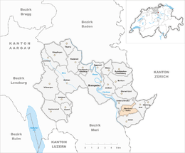
| Surrounded by | Arni, Jonen, Rottenschwil, Unterlunkhofen | |
| Website |
www SFSO statistics |
|
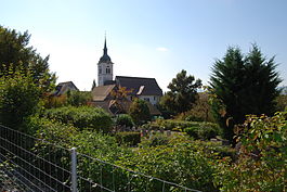
Oberlunkhofen is a municipality in the district of Bremgarten, in the canton of Aargau in Switzerland.
The earliest signs of a settlement in Oberlunkhofen are scattered Bronze Age items. In Schalchmatthau there is the foundation of a rectangular Roman era farm with a portico and flanked by two wings. Also from the Roman era, there is a 1-3rd Century villa and a bathhouse with heated rooms. Near the villa, an Alemanni graveyard was also discovered. During initial excavation, the wall remains were uncovered in 1897-98. Then, between 1975-80 the wall ruins were preserved.
The modern village of Oberlunkhofen is first mentioned in the 9th Century as Lunchunft though this record comes from an 11th Century copy of the original, older document. In 1232 it was mentioned as Lunchuft and in 1309 as obern Lunchuft. There was a castle near the village, but no surviving records mention it. It was presumably destroyed in 1386.
The village was owned by St. Leodegar in Lucerne which was under the jurisdiction of Murbach Abbey and was sold in 1291 to the House of Habsburg. In the early 14th Century is a center of the Habsburg region of Kelleramt. The rights to the low justice and the vogtei fell on Bremgarten in 1414. In 1415, the rights to high justice went to Zurich. In 1797 Bremgarten sold the village to the other four municipalities of the Kelleramt. In 1798 it became part of the short-lived Helvetic Republic Canton of Baden.
...
Wikipedia


