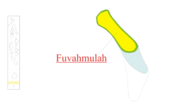
Nyaviyani Atoll
| Gnaviyani Atoll | |
|---|---|
 |
|
| Country | Maldives |
| Corresponding geographic atoll(s) | Fuvahmulah |
| Location | 0° 15' S and 0° 20' S |
| Capital | Fuvahmulah |
| Government | |
| • Atoll chief | Mohamed Falaah |
| Population | |
| • Total | 14,380 |
| Letter code | R |
| Dhivehi letter code | Gn (ޏ) |
| • Number of islands | 1 |
| • Inhabited islands | Fuvahmulah |
| Resort islands, airports and industrial islands are also considered uninhabited. | |
Gnaviyani Atoll is one of the administrative divisions of the Maldives corresponding to the natural atoll, Fuvahmulah. Surfacewise this is the smallest administrative unit in the Maldives, situated in the Equatorial Channel (Addu - Mulah Kandu) between Huvadhu Atoll and Addu Atoll.
The atoll of Fuvahmulah corresponding to this administrative division is the 25th natural atoll of the Maldives. Some people due to lack of knowledge or as part of a prevailing misconception erroneously mention that Fuvahmulah is not an atoll. An island of coral that encircles a lagoon partially or completely is what we call an atoll. In the distant past Fuvahmulah was a small coral atoll whose southern end was open at a spot called Diyarehifaando and the inside of the island was a saltwater lagoon forming a natural harbour. There is a spot in the southern end known as a Kudhuheraivali (the forest of the small islet), which indicates that there was a separate little island in that area in ancient times. But long ago the channel connecting the lagoon with the ocean was closed by massive coral boulders. Thus the inside of the island is lower than its edges. In time the inner lagoon lost its saltiness and all that remains today are two small lakes, wetlands and marshy taro fields. Therefore, Fuvahmulah is a small Atoll that closed and filled in with silt, like Nukutavake in the Central Pacific.
Fuvahmulah was traditionally divided into nine wards. From North to South these wards were: (1) Dhadimago, (2) Diguvāndo (both stretching from East to West shore), (3) Hōdhado, (5) Dhashokubaa (both segmental) separated by, (4) Mādhado (A diagonal strip of parallel width); whilst the other four divisions, which occupied the Southern part of the island consisted of two Eastern and Western strips, bisected into four wards, (6) Mālegan and (8) Dūndigan lying to East, (7) Miskimmago and (9) Funādo to West. The largest division among all is Dhadimago. With time, some changes saw its way into existence. Nowadays, the number of wards has been reduced to eight, since the village of Dhashokubaa was merged with Miskimmago. Moreover, extension of some wards with time, brought its way into certain changes in area such as that of Hōdhado. The northerly extension of the ward by time led to the land from Eastern strip of Diguvāndo and some parts of that of Dhadimago being claimed to the village. It was mainly the land consisting of agricultural fields and plantations to vegetation owned by the villagers of Dhadimago and Diguvāndo.
...
Wikipedia
