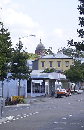
Nundah, Queensland
|
Nundah Brisbane, Queensland |
|||||||||||||
|---|---|---|---|---|---|---|---|---|---|---|---|---|---|
 |
|||||||||||||
| Coordinates | 27°24′07″S 153°03′58″E / 27.402°S 153.066°ECoordinates: 27°24′07″S 153°03′58″E / 27.402°S 153.066°E | ||||||||||||
| Population | 10,386 (2011 census) | ||||||||||||
| • Density | 2,890/km2 (7,470/sq mi) | ||||||||||||
| Postcode(s) | 4012 | ||||||||||||
| Area | 3.6 km2 (1.4 sq mi) | ||||||||||||
| LGA(s) |
City of Brisbane (Hamilton Ward;Northgate Ward) |
||||||||||||
| State electorate(s) | Clayfield, Nudgee | ||||||||||||
| Federal Division(s) | Lilley | ||||||||||||
|
|||||||||||||
Nundah (previously called German Station) is an inner suburb in the city of Brisbane, Australia, approximately 8 kilometres north-east of the Brisbane central business district, in the local government area of the City of Brisbane.
Prior to European settlement, Nundah was inhabited by Aboriginal people from the Turrbul tribe. Nundah is primarily a residential suburb, which straddles Sandgate Road, one of the major arterial roads of Brisbane's north. It was first settled by Europeans in the mid-19th century, although the suburb remained primarily a rural area until it was connected to Brisbane via railway in the 1880s. Originally considered a working-class suburb, the area has become gentrified in recent years, and today features a mix of traditional worker's cottages and modern high-density apartment blocks. It is close to the Centro Shopping Centre. The name "Nundah" means "chain of water holes" in the local Aboriginal dialect. This name is probably a reference to the nearby natural water sources at Kedron Brook and the marshy areas formerly to the east of the suburb.
Nundah is a mixed-density residential suburb, with some light industry and a commercial retail area concentrated on Sandgate Road. It is adjacent to the suburbs of Clayfield, Northgate and Wavell Heights, and is dominated by a large ridge that runs from the northwest to the southeast. The "Nundah Village" shopping district and Nundah State School are on this ridge, while the George Bridges Tunnel bisects it along Sandgate Road.
The suburb includes the locality and formerly distinct suburb of Toombul, which is centred in the south of Nundah, around Sandgate Road. Various facilities in Nundah are named after this locality, including the large shopping centre Centro Toombul, Toombul Bus Station and the Toombul railway station.
...
Wikipedia

