Nottingham, New Hampshire
| Nottingham, New Hampshire | ||
|---|---|---|
| Town | ||
|
||
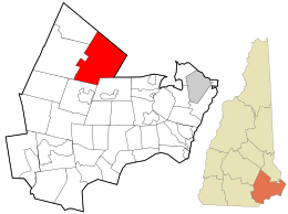
 Location in Rockingham County and the state of New Hampshire. |
||
| Coordinates: 43°06′52″N 71°05′59″W / 43.11444°N 71.09972°WCoordinates: 43°06′52″N 71°05′59″W / 43.11444°N 71.09972°W | ||
| Country | United States | |
| State | New Hampshire | |
| County | Rockingham | |
| Incorporated | 1722 | |
| Government | ||
| • Board of Selectmen | Donna Danis Tiler Eaton Charlene Andersen |
|
| • Town Administrator | Chris Sterndale | |
| Area | ||
| • Total | 48.4 sq mi (125.4 km2) | |
| • Land | 46.5 sq mi (120.4 km2) | |
| • Water | 1.9 sq mi (5.0 km2) 4.01% | |
| Elevation | 259 ft (79 m) | |
| Population (2010) | ||
| • Total | 4,785 | |
| • Density | 99/sq mi (38/km2) | |
| Time zone | Eastern (UTC-5) | |
| • Summer (DST) | Eastern (UTC-4) | |
| ZIP code | 03290 | |
| Area code(s) | 603 | |
| FIPS code | 33-57460 | |
| GNIS feature ID | 0873690 | |
| Website | www |
|
Nottingham is a town in Rockingham County, New Hampshire, United States. The population was 4,785 at the 2010 census. It is the location of Pawtuckaway State Park.
Incorporated in 1722 by Lieutenant Governor John Wentworth, Nottingham was named for Daniel Finch, 2nd Earl of Nottingham. The earl was a close friend of Samuel Shute and Joseph Dudley, previous colonial governors of New Hampshire. Among the grantees was Peregrine White, descendant of Peregrine White of the Mayflower, the first child of English parentage born in New England. At one time, the town had 17 watermills in operation.
The town was site of a massacre in 1747, when Elizabeth Simpson, Robert Beard and Nathaniel Folsom were slain by Indians of the Winnipesaukee tribe.
Nottingham once included Deerfield, incorporated in 1766, and Northwood, in 1773.
According to the United States Census Bureau, the town has a total area of 48.4 square miles (125 km2), of which 46.5 sq mi (120 km2) is land and 1.9 sq mi (4.9 km2) is water, comprising 4.01% of the town. Containing 14 lakes and ponds, Nottingham is drained by the Pawtuckaway and North rivers, in addition to Back Creek. The town's highest point is the North Peak of Mount Pawtuckaway, at 995 feet (303 m) above sea level. The circular-shaped Pawtuckaway Mountains are a prime example of what geologists term a ring dike complex.
...
Wikipedia

