Norwichtown
|
Norwichtown Historic District
|
|

Old School House
|
|
| Location | Roughly bounded by Huntington Ln., Scotland Rd., and Washington, Town and E. Town Sts., Norwich, Connecticut |
|---|---|
| Coordinates | 41°32′52″N 72°5′33″W / 41.54778°N 72.09250°WCoordinates: 41°32′52″N 72°5′33″W / 41.54778°N 72.09250°W |
| Area | 110 acres (45 ha) |
| Architect | Multiple |
| Architectural style | Colonial, Georgian |
| NRHP reference # | 73001951 |
| Added to NRHP | January 17, 1973 |
Norwichtown is a historic neighborhood in the city of Norwich, Connecticut. It is generally the area immediately north of the Yantic River between I-395 and Route 169.
The portion of the neighborhood from the Norwichtown Green and east of it is a locally designated historic district that was also listed on the National Register of Historic Places in 1973 as the Norwichtown Historic District. The district includes 48 contributing buildings and one other contributing site over an 110 acres (45 ha) area.
The earliest settlement of Norwich, in 1659, was in Norwichtown. Initial settlement, by 35 English settlers who relocated from Saybrook Fort under the leadership of Major John Mason and bought land from Uncas, sachem of the Mohegans, was centered on the Norwichtown Green.
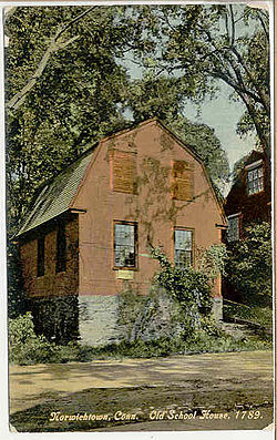
The Green is triangular in shape, with an area of about 1.75 acres (0.71 ha). It is surrounded by shade trees and bordered by Town Street, East Town Street and Elm Avenue. These streets are lined with 18th and 19th houses and shops that face the Green. There are four houses in Norwichtown that were built in the 17th century: the 1660 Bradford-Huntington House, built c. 1660; the Olmstead-Lathrop House, dating to c. 1659-1745; Leffingwell House Museum, built c. 1675; and the Simon Huntington House, built c. 1690. The First Congregational Church, built in the Federal style in 1801, was the third building to house the local congregation. Many older homes in the district have been converted to commercial use. The John Mason School is now the central administration for the Norwich Public School System. North of the town's first schoolhouse is the Colonial Cemetery where four Connecticut governors are buried. Four houses from the 17th century remain standing north of the Green area is Meeting House Hill, a cliff of large rocks that is also known as the Meeting House Rocks. It was on this cliff that the village's second and third meetinghouses were established, with the site used as a lookout point. The memorial on top of the rocks and pathway are cared for by the First Congregational Church.
...
Wikipedia


