Northampton North (UK Parliament constituency)
| Northampton North | |
|---|---|
|
Borough constituency for the House of Commons |
|

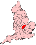
Boundary of Northampton North in Northamptonshire.
|
|

Location of Northamptonshire within England.
|
|
| County | Northamptonshire |
| Electorate | 62,095 (December 2010) |
| Major settlements | Northampton (part) |
| Current constituency | |
| Created | 1974 |
| Member of parliament | Michael Ellis (Conservative) |
| Number of members | One |
| Created from | Northampton |
| Overlaps | |
| European Parliament constituency | East Midlands |
Northampton North is a constituency represented in the House of Commons of the UK Parliament since 2010 by Michael Ellis, a Conservative.
This constituency was created for the election of February 1974 when the old constituency of Northampton was split into Northampton North and Northampton South.
Since creation it has been a bellwether, electing an MP from the winning (or largest governing) party in every general election.
1974-1983: The County Borough of Northampton wards of Abington, Dallington, Kingsthorpe, Park, St David, and St George.
1983-2010: The Borough of Northampton wards of Abington, Boughton Green, Dallington and Kings Heath, Headlands, Kingsthorpe, Links, Lumbertubs, Park, St Alban, St George, Thorplands, and Welford.
2010-present: The Borough of Northampton wards of Abington, Boughton Green, Eastfield, Headlands, Kingsley, Kingsthorpe, Lumbertubs, Parklands, St David, and Thorplands.
The constituency has income, social housing and unemployment statistics close to the national average and a varied and dynamic service and engineering-centred economy typical of the East Midlands with significant foodstuffs, clothing and consumables manufacturing and processing operations.
Coordinates: 52°15′N 0°54′W / 52.25°N 0.90°W
...
Wikipedia
