North Umpqua River
| North Umpqua River | |
|
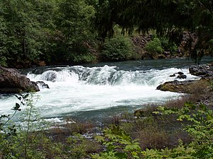
Deadline Falls on the North Umpqua River
|
|
| Country | United States |
|---|---|
| State | Oregon |
| County | Douglas |
| Source | Maidu Lake |
| - location | Cascade Range |
| - elevation | 5,998 ft (1,828 m) |
| - coordinates | 43°15′17″N 122°00′02″W / 43.25472°N 122.00056°W |
| Mouth | Confluence of the North Umpqua and South Umpqua rivers |
| - location | near Roseburg |
| - elevation | 361 ft (110 m) |
| - coordinates | 43°16′05″N 123°26′45″W / 43.26806°N 123.44583°WCoordinates: 43°16′05″N 123°26′45″W / 43.26806°N 123.44583°W |
| Length | 106 mi (171 km) |
| Basin | 1,356 sq mi (3,512 km2) |
| Discharge | for Winchester |
| - average | 3,687 cu ft/s (104 m3/s) |
| - max | 150,000 cu ft/s (4,248 m3/s) |
| - min | 235 cu ft/s (7 m3/s) |
|
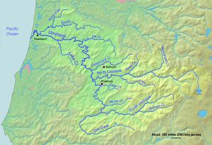
Map of the Umpqua River watershed
|
|
The North Umpqua River is a tributary of the Umpqua River, about 106 miles (171 km) long, in southwestern Oregon in the United States. It drains a scenic and rugged area of the Cascade Range southeast of Eugene, flowing through steep canyons and surrounded by large Douglas-fir forests. Renowned for its emerald green waters, it is considered one of the best fly fishing streams in the Pacific Northwest for anadromous fish.
It rises in the high Cascades, issuing from Maidu Lake at elevation of 5,998 feet (1,828 m) in the Mount Thielsen Wilderness, along the Douglas-Klamath county line approximately 70 miles (113 km) east of Roseburg. It follows a serpentine course down from the Cascades, westward along the southern side of the Calapooya Mountains. Its upper course passes through the Umpqua National Forest, past Toketee Falls and Steamboat, where it receives Steamboat Creek from the north. It receives the Little River from the south at Glide (the confluence is known as the Colliding Rivers) and joins the South Umpqua from the east approximately 5 miles (8 km) northwest of Roseburg to form the Umpqua.
...
Wikipedia


