North Island (Houtman Abrolhos)

Aerial photograph of the southern half of North Island, looking west
|
|
 |
|
| Geography | |
|---|---|
| Location | Indian Ocean, off the coast of Western Australia |
| Coordinates | 28°18′9″S 113°35′41″E / 28.30250°S 113.59472°ECoordinates: 28°18′9″S 113°35′41″E / 28.30250°S 113.59472°E |
| Archipelago | Houtman Abrolhos |
| Area | 180 ha (440 acres) |
| Length | 2 km (1.2 mi) |
| Width | 1.5 km (0.93 mi) |
| Highest elevation | 13 m (43 ft) |
| Highest point | Record Hill |
| Administration | |
|
Australia
|
|
| State | Western Australia |
| Demographics | |
| Population | Seasonally inhabited by about 130 lobster fishers (2003) |
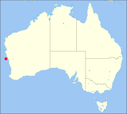
North Island is the northernmost island in the Houtman Abrolhos, a coral reef archipelago in the Indian Ocean off the coast of Mid West Western Australia. Located about 14 km (9 mi) from the nearest island group, it is one of the largest islands in the Houtman Abrolhos, and one of the few to support dune systems. It has relatively diverse flora dominated by chenopod shrubs and fauna that includes the introduced tammar wallaby, around seven species of reptile, and about 15 resident bird species.
First recorded and surveyed in 1840, North Island has been a seasonal camp for western rock lobster fishermen since the beginning of the 20th century, and this remains the principal focus of human activity on the island. There is also a small amount of tourism, though for the most part it is reserved as conservation habitat for vegetation communities and rare birds.
The earliest recorded sighting of North Island occurred in May 1840, during the third survey voyage of HMS Beagle, commanded by John Clements Wickham. It was sighted from the peak of Flag Hill on East Wallabi Island in early May, explored on 22 May, and given its name due to "its relative position to the remainder of Houtman's Abrolhos". Before he left the island, Wickham left a letter in a bottle atop the highest hill, which he accordingly christened Record Hill.
A map of the island first appeared in 1845 on a British Admiralty chart entitled "The Houtman Rocks". The following year, Wickham's lieutenant, John Lort Stokes, published the first account of the island in his Discoveries in Australia. He observed:
...
Wikipedia
