North East Milton Keynes (UK Parliament constituency)
| North East Milton Keynes | |
|---|---|
| Former County constituency for the House of Commons |
|

Boundary of North East Milton Keynes in Buckinghamshire for the 2005 general election.
|
|

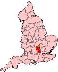
Location of Buckinghamshire within England.
|
|
| County | Buckinghamshire |
| 1992–2010 | |
| Number of members | One |
| Replaced by | Milton Keynes North, Milton Keynes South |
| Created from | Milton Keynes |
Coordinates: 52°03′22″N 0°38′53″W / 52.056°N 0.648°W
North East Milton Keynes was a county constituency represented in the House of Commons of the Parliament of the United Kingdom from 1992 to 2010. It elected one member of parliament (MP) by the first past the post system of election.
The constituency was one of two covering the Milton Keynes borough. It covered the remaining parts of the town of Milton Keynes not in the Milton Keynes South West constituency, as well as the older settlement of Newport Pagnell and the more rural parts of the borough, around Hanslope and Olney.
The constituency consisted of 10 electoral wards of the Borough of Milton Keynes: Bradwell, Danesborough, Lavendon, Linford, Newport Pagnell, Olney, Pineham, Sherington, Stantonbury, and Woburn Sands.
Following the Fifth Periodic Review of Westminster constituencies into parliamentary representation in Buckinghamshire, the Boundary Commission for England recommended changes to the existing Milton Keynes constituencies. Beginning with the 2010 United Kingdom general election, there would continue to be two parliamentary constituencies for Milton Keynes, but they would be formed on a different basis, abolishing the Milton Keynes North East and Milton Keynes South West constituencies after four general elections of use.
...
Wikipedia
