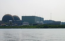
North Anna Nuclear Generating Station
| North Anna Power Station | |
|---|---|

North Anna NPP
|
|
| Country | United States |
| Location | Louisa County, near Mineral, Virginia |
| Coordinates | 38°3′38″N 77°47′22″W / 38.06056°N 77.78944°WCoordinates: 38°3′38″N 77°47′22″W / 38.06056°N 77.78944°W |
| Status | Operational |
| Commission date | Unit 1: June 6, 1978 Unit 2: December 14, 1980 |
| Operator(s) | Dominion |
| Nuclear power station | |
| Reactor type | Pressurized water reactor |
| Reactor supplier | Westinghouse |
| Power generation | |
| Units operational | 1,790 MW (2 reactors) |
| Units planned | 1 x 1,700 MW |
|
Website North Anna Power Station |
|
The North Anna Nuclear Generating Station is a nuclear power plant on a 1,075-acre (435 ha) site in Louisa County, Virginia, in the Mid-Atlantic United States. The site is operated by Dominion Generation company and is jointly owned by the Dominion Virginia Power corporation (88.4%) and by the Old Dominion Electric Cooperative (11.6%).
The plant has two Westinghouse pressurized water reactors which went on-line in 1978 and 1980 respectively. Together the reactors generate 1.79 gigawatts of power, which is distributed mainly to the greater Richmond area and to Northern Virginia. In March 2003, the NRC approved 20 year license extensions for both Units 1 & 2.
An artificial lake, Lake Anna, was constructed on the North Anna River to provide a reservoir of water coolant for use with the nuclear plant.
Dominion currently owns nuclear power plants in Virginia (North Anna, Surry), Connecticut (Millstone), and Wisconsin (Kewaunee). North Anna is similar in design and appearance to Surry Power Station.
The Nuclear Regulatory Commission (NRC) defines two emergency planning zones around nuclear power plants: a plume exposure pathway zone with a radius of 10 miles (16 km), concerned primarily with exposure to, and inhalation of, airborne radioactive contamination, and an ingestion pathway zone of about 50 miles (80 km), concerned primarily with ingestion of food and liquid contaminated by radioactivity.
...
Wikipedia

