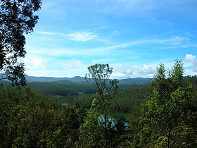
Nilgiri Hills
| Nilgiri Hills | |
|---|---|

View of Nilgiri Hills
|
|
| Highest point | |
| Elevation | 2,637 m (8,652 ft) |
| Naming | |
| Translation | Blue Mountains |
| Geography | |
| Location | Tamil Nadu, Kerala, Karnataka |
| Parent range | Western Ghats |
| Geology | |
| Age of rock | Azoic Age, 3000 to 500 mya |
| Mountain type | Fault |
| Climbing | |
| Easiest route | NH 67 (Satellite view) or Nilgiri Mountain Railway |
The Nilgiri (Blue Mountains), form part of the Western Ghats in western Tamil Nadu, Karnataka and Kerala states in Southern India. At least 24 of the Nilgiri mountains' peaks are above 2,000 metres (6,600 ft), the highest peak being Doddabetta, at 2,637 metres (8,652 ft).
Spanning an area of 2,479 square kilometres (957 sq mi), the mountains' central location is 11°22′30″N 76°45′30″E / 11.37500°N 76.75833°E.
The Nilgiris District of Tamil Nadu lies within these mountains, spanning 130 km (Latitude: 11° 08' to 11° 37' N) by 185 km (Longitude: 76° 27' E to 77° 4' E). It is connected via Nilgiri Mountain Railway.
The mountains are separated from other geographical features by the Moyar River to the north (Karnataka plateau is beyond), and the Palghat Gap to the south (Anaimalai Hills and Palni Hills are past this).
The Nilgiri Hills are part of the Nilgiri Biosphere Reserve (itself part of the UNESCO World Network of Biosphere Reserves.), and form a part of the protected bio reserves in India.
...
Wikipedia
