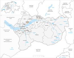
Niederried bei Interlaken
| Niederried bei Interlaken | ||
|---|---|---|
 |
||
|
||
| Coordinates: 46°43′N 7°55′E / 46.717°N 7.917°ECoordinates: 46°43′N 7°55′E / 46.717°N 7.917°E | ||
| Country | Switzerland | |
| Canton | Bern | |
| District | Interlaken-Oberhasli | |
| Government | ||
| • Mayor | Hans Studer | |
| Area | ||
| • Total | 4.29 km2 (1.66 sq mi) | |
| Elevation | 578 m (1,896 ft) | |
| Population (Dec 2015) | ||
| • Total | 347 | |
| • Density | 81/km2 (210/sq mi) | |
| Postal code | 3853 | |
| SFOS number | 0588 | |
| Surrounded by | Habkern, Oberried am Brienzersee and Ringgenberg | |
| Website |
www SFSO statistics |
|
Niederried bei Interlaken is a municipality in the Interlaken-Oberhasli administrative district in the canton of Bern in Switzerland.
Niederried bei Interlaken is first mentioned in 1291 as Riede.
The oldest trace of a settlement in the area is a neolithic grave in Ursisbalm and a La Tène grave at Städeli. The village only rarely appeared in historical records after its founding. Between 1411 and 1439 the Herrschaft of Ringgenberg, which included Niederried, was given to Interlaken Abbey. In 1528, the city of Bern adopted the new faith of the Protestant Reformation and began imposing it on the Bernese Oberland. The Abbey unsuccessfully rebelled against the new faith. After Bern imposed its will on the Oberland, they secularized the Abbey and annexed all the Abbey lands. Niederried became a part of the Bernese bailiwick of Interlaken.
The village occupies a narrow strip of land between the lake and the mountains so there was very little land for farming. During the 19th century some tourists visited the village and in 1877 a pier was built for the tourist steam ships. In 1916 the last leg of the Brünig railway line was completed, which passed through the narrow village.
The name means "lower Ried near Interlaken." There are two explanations for the origin of the name Ried: from the Old High German riod, reoth ("clearing") or the Swiss German Ried (land growing reeds and swampgrass).
...
Wikipedia


