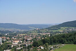
Niederlenz
| Niederlenz | ||
|---|---|---|
 |
||
|
||
| Coordinates: 47°24′N 8°11′E / 47.400°N 8.183°ECoordinates: 47°24′N 8°11′E / 47.400°N 8.183°E | ||
| Country | Switzerland | |
| Canton | Aargau | |
| District | Lenzburg | |
| Area | ||
| • Total | 3.3 km2 (1.3 sq mi) | |
| Elevation | 377 m (1,237 ft) | |
| Population (Dec 2015) | ||
| • Total | 4,546 | |
| • Density | 1,400/km2 (3,600/sq mi) | |
| Postal code | 5702 | |
| SFOS number | 4204 | |
| Surrounded by | Lenzburg, Möriken-Wildegg, Rupperswil | |
| Website |
www SFSO statistics |
|
Niederlenz is a municipality in the district of Lenzburg in the canton of Aargau in Switzerland.
The center of the village comes from a middle Bronze Age settlement and a later Roman era farm. However, the modern village of Niederlenz is first mentioned in 924 as de Lencis. In 1261-64 it was mentioned as Nider-Lenz. The high justice rights were held by Schloss Lenzburg until 1433 when those rights, along with the rights to low justice, were purchased by Bern. Later, the low justice rights reverted to the four villages of Niederlenz, Hunzenschwil, Rupperswil and Staufen. In 1480 village was incorporated with a local government. The village mill was built before 1461 and was pawned by Hans Heinrich of Rinach and then sold in 1486 to Hans von Hallwyl. It was in the possession of the Kull family for generations.
It was originally part of the Staufberg parish. The village got its own church in 1949 and in 1990 became its own parish.
Niederlenz has an area, as of 2009[update], of 3.3 square kilometers (1.3 sq mi). Of this area, 0.97 km2 (0.37 sq mi) or 29.4% is used for agricultural purposes, while 0.85 km2 (0.33 sq mi) or 25.8% is forested. Of the rest of the land, 1.43 km2 (0.55 sq mi) or 43.3% is settled (buildings or roads), 0.02 km2 (4.9 acres) or 0.6% is either rivers or lakes and 0.01 km2 (2.5 acres) or 0.3% is unproductive land.
Of the built up area, industrial buildings made up 5.5% of the total area while housing and buildings made up 22.7% and transportation infrastructure made up 9.4%. Power and water infrastructure as well as other special developed areas made up 3.0% of the area while parks, green belts and sports fields made up 2.7%. Out of the forested land, all of the forested land area is covered with heavy forests. Of the agricultural land, 23.9% is used for growing crops and 4.8% is pastures. All the water in the municipality is in rivers and streams.
...
Wikipedia


