Newton, South Lanarkshire
Newton, South Lanarkshire
|
|
|---|---|
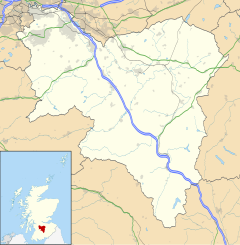
| Newton, South Lanarkshire shown within South Lanarkshire | |
| Council area | |
| Country | Scotland |
| Sovereign state | United Kingdom |
| Dialling code | 0141 |
| Police | Scottish |
| Fire | Scottish |
| Ambulance | Scottish |
| EU Parliament | Scotland |
| UK Parliament | |
| Scottish Parliament | |
Newton is a mainly residential district in the Scottish town of Cambuslang in South Lanarkshire Council area (part of the Cambuslang East ward). It is situated south of the River Clyde - the river borders the district to the north.
The name is familiar to many in the Greater Glasgow area as a terminus on the suburban railway system (Newton Station). The railway line marks the southern boundary of the area, while to the west Newton is separated from the neighbouring village of Westburn by the small Newton Burn, and to the east it is separated from farmland belonging to the town of Blantyre by the Rotten Calder river which flows into the Clyde.
Originally lands owned by the Clan Hamilton, Newton grew as a mining village in the late 19th Century. Rows of miners’ cottages were built along with local schools, churches and shops. There were several collieries in the vicinity and large bings appeared on the landscape. The settlement reached its greatest extent around 1910. The parish town of Cambuslang also became heavily industrialised and grew substantially in population.
Since 1849 the area had been served by a train station, and when this was replaced in 1873 it coincided with the opening of the large Hallside steelworks. However, unlike nearby districts also served by stations on the same lines such as Uddingston, Kirkhill and Burnside, Newton did not become a railway commuter suburb for Glasgow at that time.
...
Wikipedia

