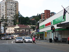
New South Head Road, Sydney
|
New South Head Road New South Wales |
|
|---|---|
 |
|
| New South Head Road, Double Bay | |
| Type | Road |
| Length | 6.8 km (4.2 mi) |
| Southwest end | Neild Avenue, Rushcutters Bay |
|
|
| Northeast end | Old South Head Road, Vaucluse |
| Major suburbs | Edgecliff, Double Bay, Point Piper, Rose Bay |
New South Head Road, is a major road in the Eastern Suburbs of Sydney. The road runs north-east from Rushcutters Bay through Edgecliff, Double Bay, Point Piper, Rose Bay and Vaucluse where it finally merges into Old South Head Road.
Prior to the road's construction the main route to the southern headland was South Head Road, which led to the signal station following the route of modern-day Old South Head Road and Oxford Street. In 1831, construction began on New South Head Road. The road was to follow the route of the Aboriginal foot track Maroo, which contoured between south head and Sydney. Before construction began on New South Head Road, only Aborigines and men stationed at the South Head Lookout Post used the track.
For the first few years of construction progress was slow and only parts of the road began to develop, as work was treacherous with the route offering a range of harsh environments such as the low lying swamplands of Rushcutters Bay, Double Bay and Rose Bay, to the steep cliff faces of Vaucluse and Watsons Bay; in addition, the bush lands surrounding the Maroo Track were reportedly infested with snakes. However, by 1834 efforts had increased, and the road began to take shape. Where the road crosses Rushcutters Creek, a succession of bridges were built, starting with a timber bridge around 1834, followed by a stone bridge erected between 1837 and 1839. Bentley's Bridge, as it came to be known, was built by convicts under supervision of Lieutenant ACD Bentley. By the late 1830s, the road was able to cater for carts and stretched from Rushcutters Bay to Vaucluse, finally providing Sydneysiders a coastal thoroughfare along the southern banks of the harbour.
Due to the poor condition of the New South Head Road and its southern predecessor Old South Head Road a trust was set up by a government act in May 1848. The trust was given the responsibility of maintaining the twenty four kilometres of road under its control. To raise the funds to maintain the roads the Trust set up tolls, one of which was located on New South Head Road in the form of a turnpike gate that extracted tolls from the road users. Unfortunately for the occupants of newly developed suburbs on South Head such as Vaucluse, the trust failed to adequately delegate funds and maintenance of the road remained poor until the trust was disbanded in 1904.
...
Wikipedia
