Neunforn
| Neunforn | ||
|---|---|---|

The old school house in Fahrhof
|
||
|
||
| Coordinates: 47°36′N 8°47′E / 47.600°N 8.783°ECoordinates: 47°36′N 8°47′E / 47.600°N 8.783°E | ||
| Country | Switzerland | |
| Canton | Thurgau | |
| District | Frauenfeld | |
| Area | ||
| • Total | 11.36 km2 (4.39 sq mi) | |
| Elevation | 460 m (1,510 ft) | |
| Population (Dec 2015) | ||
| • Total | 963 | |
| • Density | 85/km2 (220/sq mi) | |
| Postal code | 8525 | |
| SFOS number | 4601 | |
| Localities | Niederneunforn, Oberneunforn, Wilen bei Neunforn | |
| Surrounded by | Altikon (ZH), Hüttwilen, Oberstammheim (ZH), Ossingen (ZH), Thalheim an der Thur (ZH), Uesslingen-Buch, Waltalingen (ZH) | |
| Website |
www SFSO statistics |
|
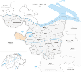
Neunforn is a municipality in the district of Frauenfeld in the canton of Thurgau in Switzerland.
Neunforn is first mentioned in 962 as Niuvora. In 963 a court was mentioned in the village. The Freiherr of Teufen sold his property in Neunforn to Töss Monastery in 1250. The high and low courts in Niederneunforn were merged in 1500 and in 1554 both courts were acquired by Stokar from Schaffhausen. From 1694 until 1798 the courts were owned by Zurich. The parish included Oberneunforn, Niederneunforn, Wilen and Burghof. In 1265, the parish was given as a donation to Töss Monastery, and was incorporated into the abbey in 1291. The Reformation reached and converted Neunforn in 1525. During the Protestant Reformation, Zurich closed Töss Monastery and took over the parish rights in Neunforn. Zurich retained the right to appoint the preacher in the parish until 1843.
Neunforn has an area, as of 2009[update], of 11.36 square kilometers (4.39 sq mi). Of this area, 7.46 km2 (2.88 sq mi) or 65.7% is used for agricultural purposes, while 2.78 km2 (1.07 sq mi) or 24.5% is forested. Of the rest of the land, 0.82 km2 (0.32 sq mi) or 7.2% is settled (buildings or roads), 0.19 km2 (0.073 sq mi) or 1.7% is either rivers or lakes and 0.12 km2 (30 acres) or 1.1% is unproductive land.
Of the built up area, industrial buildings made up 3.3% of the total area while housing and buildings made up 0.1% and transportation infrastructure made up 0.4%. while parks, green belts and sports fields made up 3.4%. Out of the forested land, 23.2% of the total land area is heavily forested and 1.2% is covered with orchards or small clusters of trees. Of the agricultural land, 58.5% is used for growing crops, while 7.1% is used for orchards or vine crops. Of the water in the municipality, 0.2% is in lakes and 1.5% is in rivers and streams.
...
Wikipedia


