Netherlee
| Netherlee | |
|---|---|
 Ormonde Crescent, with a view towards Glasgow and the Campsie Fells in the distance |
|
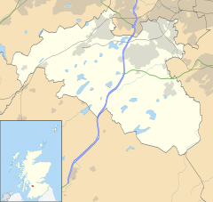
| Netherlee shown within East Renfrewshire | |
| Population | 4,550 (2012 est.) |
| OS grid reference | NS575585 |
| • Edinburgh | 43 mi (69 km) ENE |
| • London | 342 mi (550 km) SSE |
| Council area | |
| Lieutenancy area | |
| Country | Scotland |
| Sovereign state | United Kingdom |
| Post town | GLASGOW |
| Postcode district | G44 |
| Dialling code | 0141 |
| Police | Scottish |
| Fire | Scottish |
| Ambulance | Scottish |
| EU Parliament | Scotland |
| UK Parliament | |
| Scottish Parliament | |
Netherlee is a suburban residential area in East Renfrewshire, Scotland. Part of the Greater Glasgow conurbation, it is situated on the west bank of the White Cart Water about 4 miles (6.5 km) south of Glasgow city centre, and just outside the city boundary.
Originally a small rural hamlet dependent upon the mills along the river, Netherlee became extensively urbanised in the 20th century, developing into an affluent commuter suburb. In a 2014 Royal Mail survey, the G44 postcode – which includes Netherlee – was rated as the most desirable area of Scotland to live in. As of 2012, the area has a population of 4,550.
Netherlee is served by a parish church, primary school and library, as well as a number of local shops. Cathcart Cemetery also falls within the boundaries of the area.
In the medieval era, the area of modern Netherlee and Clarkston was known as the Lands of Lee, centred on Lee Castle. The small hill on which the castle stood is now the park behind Netherlee Post Office. In the 15th century, the Lands of Lee were split up into Netherlee, Midlee (now Stamperland) and Overlee (now part of Clarkston). From the 1660s onwards, the Maxwell family of Bogton (modern Muirend) developed the original Williamwood House and the surrounding Williamwood Estate. The house was built adjacent to the site of Lee Castle, the latter being demolished around this time.
Until the late 19th century, Netherlee was a small rural village along the main road from Glasgow to Clarkston (the present day Netherlee Road). Many local residents were employed in the printworks on the bank of the River Cart. The early years of the 20th century saw the first phase of urbanisation, with the development of the present line of Clarkston Road and the shifting of the settlement's focus westwards along this new route from Cathcart and Muirend to Clarkston. From this time onwards, new housing developments, typically red sandstone terraces, began to eat up former agricultural land. Due to building restrictions as a result of the First World War, however, it was not until the 1920s that the majority of residential streets off the main artery were fully developed as they appear today.
...
Wikipedia

