Nepalgunj Airport
| Nepalgunj Airport | |||||||||||
|---|---|---|---|---|---|---|---|---|---|---|---|
 |
|||||||||||
| Summary | |||||||||||
| Airport type | Public | ||||||||||
| Operator | Government | ||||||||||
| Serves | Nepalgunj, Nepal | ||||||||||
| Elevation AMSL | 540 ft / 165 m | ||||||||||
| Coordinates | 28°06′13″N 081°40′01″E / 28.10361°N 81.66694°E | ||||||||||
| Map | |||||||||||
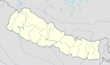
| Location of airport in Nepal | |||||||||||
| Runways | |||||||||||
|
|||||||||||
|
Source: DAFIF
|
|||||||||||
Nepalgunj Airport (IATA: KEP, ICAO: VNNG) is an airport serving Nepalgunj (also spelled Nepalganj), a Sub-Metropolitan Municipality in Banke District of Province No. 5 in Nepal. The airport is capable of handling aircraft from the Nepalese Army Air Service.
The airport has been in service since 1961. In land area it is the second largest airport in Nepal, after TIA. It also has the second greatest number of aircraft and passenger movements. After the introduction of FK-100 jet aircraft, passenger movement at this airport increased by 13.39% in 2005 (up to November) against the figure in the year 2004.
Recently, the Civil Aviation Authority of Nepal (CAAN) has permitted Flying Dragon Airlines, a joint venture company of Nepal and China, to operate remote areas of mid - and far - western development region with operating base at this airport.
website : www.nepalgunjairport.com.np
The airport resides at an elevation of 540 feet (165 m) above mean sea level. It has one runway designated 08/26 with an asphalt surface measuring 1,504 by 30 metres (4,934 ft × 98 ft).
...
Wikipedia

