Nebine, Queensland
|
Nebine Queensland |
|||||||||||||||
|---|---|---|---|---|---|---|---|---|---|---|---|---|---|---|---|

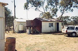
Nebine Library, 1990
|
|||||||||||||||
| Coordinates | 28°03′52″S 146°48′51″E / 28.0645°S 146.8142°ECoordinates: 28°03′52″S 146°48′51″E / 28.0645°S 146.8142°E | ||||||||||||||
| Postcode(s) | 4488 | ||||||||||||||
| Area | 5,197.1 km2 (2,006.6 sq mi) | ||||||||||||||
| LGA(s) | Shire of Paroo | ||||||||||||||
| State electorate(s) | Warrego | ||||||||||||||
| Federal Division(s) | Maranoa | ||||||||||||||
|
|||||||||||||||
Nebine is a locality in the Shire of Paroo, Queensland, Australia.
The Balonne Highway passes from east to west through the centre of the locality with a junction to the Balonne Charleville Road which exits the locality in the north.
The locality is flat (about 190 metres above sea level). Nebine Creek flows from north to south through the locality.
...
Wikipedia

