Naturita, Colorado
| Town of Naturita, Colorado | |
|---|---|
| Town | |
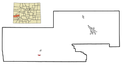
 Location in Montrose County and the state of Colorado |
|
| Coordinates: 38°13′11″N 108°34′3″W / 38.21972°N 108.56750°WCoordinates: 38°13′11″N 108°34′3″W / 38.21972°N 108.56750°W | |
| Country |
|
| State |
|
| County | Montrose |
| Incorporated (town) | November 30, 1951 |
| Government | |
| • Type | Statutory Town |
| Area | |
| • Total | 0.7 sq mi (1.9 km2) |
| • Land | 0.7 sq mi (1.9 km2) |
| • Water | 0 sq mi (0 km2) |
| Elevation | 5,423 ft (1,653 m) |
| Population (2000) | |
| • Total | 635 |
| • Density | 907.1/sq mi (334.2/km2) |
| Time zone | Mountain (MST) (UTC-7) |
| • Summer (DST) | MDT (UTC-6) |
| ZIP code | 81422 |
| Area code(s) | 970 |
| FIPS code | 08-53120 |
| GNIS feature ID | 0186027 |
Naturita is a Statutory Town in Montrose County, Colorado, United States. The population was 635 at the 2000 census.
A post office called Naturita has been in operation since 1882. Naturita is a name derived from Spanish meaning "little nature".
Naturita is located at 38°13′11″N 108°34′3″W / 38.21972°N 108.56750°W (38.219756, -108.567454).
According to the United States Census Bureau, the town has a total area of 0.7 square miles (1.8 km2), all of it land. Naturita is located in an area of desert land, surrounding the Uncompahgre National Forest in western Colorado.
The average low in January is 16 degrees Fahrenheit, while the average high in July rises to 96 degrees Fahrenheit.
As of the census of 2000, there were 635 people, 257 households, and 164 families residing in the town. The population density was 865.5 people per square mile (335.9/km²). There were 314 housing units at an average density of 428.0 per square mile (166.1/km²). The racial makeup of the town was 93.70% White, 2.36% Native American, 0.16% Asian, 1.73% from other races, and 2.05% from two or more races. Hispanic or Latino of any race were 5.04% of the population.
...
Wikipedia
