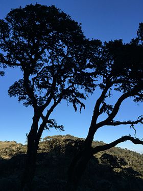
Nat Ma Taung
| Nat Ma Taung | |
|---|---|
| Khaw-nu-soum / Mount Victoria | |

Nat Ma Taung/Mount Victoria
|
|
| Highest point | |
| Elevation | 3,070 m (10,070 ft) |
| Prominence | 2,148 m (7,047 ft) |
| Listing | List of Ultras of Southeast Asia |
| Coordinates | 21°14′00″N 93°54′00″E / 21.23333°N 93.90000°ECoordinates: 21°14′00″N 93°54′00″E / 21.23333°N 93.90000°E |
| Geography | |
| Location | Chin State, Burma |
| Parent range | Chin Hills |
| Climbing | |
| First ascent | unknown |
| Easiest route | climb |
Nat Ma Taung (Burmese: နတ်မတောင်; also known as Mount Victoria and Khaw-nu-soum or Khonuamthung in Chin), is the highest mountain in the Chin State of western Burma. Located in 3 Townships - Kanpatlet, Mindat and Matupi, Mount Victoria is part of the Chin Hills range. The park is administered by the Department of Forestry and Environment.
With a height of 3,053 metres (10,016 ft) above sea level and a prominence of 2,231 metres (7,320 ft), Nat Ma Taung is one of the ultra prominent peaks of Southeast Asia.
Nat Ma Taung lies in the Chin Hills-Arakan Yoma montane forests ecoregion. Surrounded at lower elevations by tropical and subtropical moist forests, Nat Ma Taung's higher elevations form a sky island, home to many temperate and alpine species typical of the Himalaya further north, as well as many endemic species.
The mountain is now protected within Nat Ma Taung National Park (နတ်မတောင်အမျိုးသားဥယျာဉ်), established in 1994.
The base of this national park can be reached either via Kanpetlet Township (easy access) or via Mindat Township, the latter is not easy as the road is incomplete. The only public transport that reaches the base of the mountain is a four-WD jeep that plies between Soe and mountain base via kanpetlet in the dry season. The road up to the lodge after Kanpetlet town is sealed and beyond is an earthen tract. The tract is not navigable even by a 4-WD in the wet season due to severe damage by storm water. The tract is the main access to about 20 villages near the base of the mountain. At the base of the mountain, one tract leads to villages, the centre tract leads to the peak and the other one traverses to Mindat Township and them on to Soe Township. Due to tract damage, tourists, many national and few international, visit the mountain mainly in the dry season. The tract is navigable by a 4-WD car all the way to the peak.
...
Wikipedia

