Narberth, Pennsylvania
| Borough of Narberth | |
| Borough | |
|
House in the Narbrook Park Historic District
|
|
| Country | United States |
|---|---|
| State | Pennsylvania |
| County | Montgomery |
| Elevation | 308 ft (93.9 m) |
| Coordinates | 40°00′27″N 75°15′44″W / 40.00750°N 75.26222°WCoordinates: 40°00′27″N 75°15′44″W / 40.00750°N 75.26222°W |
| Area | 0.5 sq mi (1.3 km2) |
| - land | 0.5 sq mi (1 km2) |
| - water | 0.0 sq mi (0 km2), 0% |
| Population | 4,282 (2010) |
| Density | 8,571.7/sq mi (3,309.6/km2) |
| Settled | 1682 |
| Government | Council-manager |
| Mayor | Tom Grady (D) |
| Timezone | EST (UTC-5) |
| - summer (DST) | EDT (UTC-4) |
| ZIP code | 19072 |
| Area code | 610 and 484 |
|
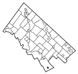
Location of Narberth in Montgomery County
|
|
|
Website: www |
|
Narberth is a borough in Montgomery County, Pennsylvania, United States. It is one of many neighborhoods on the historic Pennsylvania Main Line. The population was 4,282 at the 2010 census.
Narberth is located on a parcel of land originally deeded to Edward Rees (which later became “Prees” and eventually “Price”), who arrived from Wales in 1682. A portion of this original tract became the 100-acre (0.40 km2) farm of Edward R. Price, who founded Elm as a Quaker-friendly town in 1881. The town name changed to Narberth in 1893, and Narberth was incorporated in 1895. In 1995, the borough celebrated its 100th birthday with a year-long celebration.
The Narbrook Park Historic District was listed on the National Register of Historic Places in 2003.
As of the 2010 census, the borough was 90.4% White, 1.9% Black or African American, 4.4% Asian, 0.1% Native Hawaiian, and 2.7% were two or more races. 2.4% of the population were of Hispanic or Latino ancestry.
As of the census of 2000, there were 4,233 people, 1,904 households, and 1,037 families residing in the borough. The population density was 8,571.7 people per square mile (3,335.4/km2). There were 1,981 housing units at an average density of 4,011.5 per square mile (1,561.0/km2). The racial makeup of the borough was 95.23% White, 1.18% African American, 0.12% Native American, 2.27% Asian, 0.14% from other races, and 1.06% from two or more races. Hispanic or Latino of any race were 1.39% of the population.
...
Wikipedia


