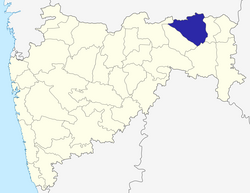
Nagpur district
|
Nagpur district नागपूर जिल्हा |
|
|---|---|
| District of Maharashtra | |
 Location of Nagpur district in Maharashtra |
|
| Country | India |
| State | Maharashtra |
| Administrative division | Nagpur Division |
| Headquarters | Nagpur |
| Tehsils | 1. Ramtek, 2. Umred, 3. Kalameshwar, 4. Katol, 5. Kamthi, 6. Kuhi, 7. Narkhed, 8. Nagpur, 9. Nagpur (Rural), 10. Parseoni, 11. Bhiwapur, 12. Mouda, 13. Savner, 14. Hingna |
| Government | |
| • Lok Sabha constituencies | 1. Nagpur, 2. Ramtek (SC) (Based on Election Commission website) |
| Area | |
| • Total | 9,897 km2 (3,821 sq mi) |
| Population (2011) | |
| • Total | 4,653,171 |
| • Density | 470/km2 (1,200/sq mi) |
| • Urban | 64.26% |
| Demographics | |
| • Literacy | 89.5% |
| • Sex ratio | 948 |
| Major highways | NH-6, NH-7 |
| Average annual precipitation | 1205 mm |
| Website | Official website |
| Nagpur | ||||||||||||||||||||||||||||||||||||||||||||||||||||||||||||
|---|---|---|---|---|---|---|---|---|---|---|---|---|---|---|---|---|---|---|---|---|---|---|---|---|---|---|---|---|---|---|---|---|---|---|---|---|---|---|---|---|---|---|---|---|---|---|---|---|---|---|---|---|---|---|---|---|---|---|---|---|
| Climate chart () | ||||||||||||||||||||||||||||||||||||||||||||||||||||||||||||
|
||||||||||||||||||||||||||||||||||||||||||||||||||||||||||||
|
||||||||||||||||||||||||||||||||||||||||||||||||||||||||||||
| J | F | M | A | M | J | J | A | S | O | N | D |
|
10
29
12
|
12
32
15
|
18
36
19
|
13
40
24
|
16
43
28
|
172
38
26
|
304
32
24
|
292
30
24
|
194
32
23
|
51
33
20
|
12
30
15
|
17
28
12
|
| Average max. and min. temperatures in °C | |||||||||||
| Precipitation totals in mm | |||||||||||
| Source: World Weather Information Service | |||||||||||
| Imperial conversion | |||||||||||
|---|---|---|---|---|---|---|---|---|---|---|---|
| J | F | M | A | M | J | J | A | S | O | N | D |
|
0.4
83
54
|
0.5
90
59
|
0.7
97
66
|
0.5
104
75
|
0.6
109
82
|
6.8
100
79
|
12
89
75
|
11
87
74
|
7.6
89
73
|
2
91
68
|
0.5
87
59
|
0.7
83
54
|
| Average max. and min. temperatures in °F | |||||||||||
| Precipitation totals in inches | |||||||||||
...
Wikipedia
