Muskegon County
| Muskegon County, Michigan | ||
|---|---|---|

Muskegon County Courthouse
|
||
|
||
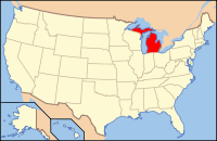
 Location in the U.S. state of Michigan |
||
 Michigan's location in the U.S. |
||
| Founded | 1859 | |
| Named for | Muskegon River | |
| Seat | Muskegon | |
| Largest city | Norton Shores (area), Muskegon (population) | |
| Area | ||
| • Total | 1,460 sq mi (3,781 km2) | |
| • Land | 499 sq mi (1,292 km2) | |
| • Water | 961 sq mi (2,489 km2), 66% | |
| Population | ||
| • Total | 172,344 | |
| • Density | 345/sq mi (133/km²) | |
| Congressional district | 2nd | |
| Time zone | Eastern: UTC-5/-4 | |
| Website | www |
|
Muskegon County is a county located in the U.S. state of Michigan. As of 2014, the population was 172,344. The county seat is Muskegon.
Muskegon County comprises the Muskegon, MI Metropolitan Statistical Area, which is part of the larger Grand Rapids-Wyoming-Muskegon, MI Combined Statistical Area. The White River flows through the county to its mouth at Lake Michigan.
Around 1812, Jean Baptiste Recollect and Pierre Constant set up trading posts in the area. By the Treaty of Washington (1836), Native Americans ceded parts of Michigan, including future Muskegon County, to the United States. This opened up the area to greater settlement by European Americans, who developed farms.
Muskegon County was organized in 1859. Its name is from the Muskegon River, which runs through it and empties into Muskegon Lake and subsequently flows into Lake Michigan. The word "Muskegon" comes from the Ojibwa/Chippewa word mashkig, meaning "marsh" or "swamp".See List of Michigan county name etymologies.
According to the U.S. Census Bureau, the county has a total area of 1,460 square miles (3,800 km2), of which 499 square miles (1,290 km2) is land and 961 square miles (2,490 km2) (66%) is water.
...
Wikipedia

