Munshiganj
|
Munshiganj মুন্সীগঞ্জ |
|
|---|---|
| District | |

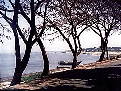
Dhaleshwari River bank, Munshiganj Sadar Upazila in Munsiganj District
|
|
| Nickname(s): Bikrampur | |
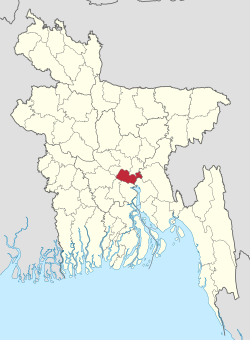
 Location of Munshiganj in Bangladesh |
|
| Coordinates: 23°28′N 90°32′E / 23.46°N 90.54°ECoordinates: 23°28′N 90°32′E / 23.46°N 90.54°E | |
| Country |
|
| Division | Dhaka Division |
| Area | |
| • Total | 1,004.29 km2 (387.76 sq mi) |
| Population (2011 census) | |
| • Total | 1,445,660 |
| • Density | 1,400/km2 (3,700/sq mi) |
| Time zone | BST (UTC+6) |
Munshiganj (Bengali: মুন্সীগঞ্জ), also historically known as Bikrampur, is a district in central Bangladesh. It is a part of the Dhaka Division and borders Dhaka District.
Total land area is 235974 acres (954 km2), out of which 138472 acres (560 km2) are cultivable and 5609 acres (23 km2) are fallow land. It has no forest area. 40277 acres (163 km2) of land is irrigated while 26242 acres (106 km2) of land is under river. It has 14 rivers of 155 km passing through.
The district consists of 6 upazilas:
Bikrampur (Munshiganj) was the political and cultural centre of ancient Bengal. It was officially known as Bikrampur until 1986 and was part of Dhaka District. The remains of the city of Bikrampur, the capital of the ancient kingdoms of southeastern Bengal, are lost and its location can only be guessed on the basis of available data.
Revolutionary Nationalists
Social & Scientific
Art, Culture & Sports
Public Affairs
...
Wikipedia
