Municipality of Mirna Peč
|
Municipality of Mirna Peč Občina Mirna Peč |
|
|---|---|
| Municipality | |

The Mirna Peč Valley
|
|
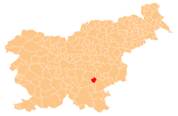
 Location of the Municipality of Mirna Peč in Slovenia |
|
| Coordinates: 45°51′29″N 15°05′15″E / 45.85806°N 15.08750°ECoordinates: 45°51′29″N 15°05′15″E / 45.85806°N 15.08750°E | |
| Country |
|
| Government | |
| • Mayor | Andrej Kastelic |
| Area | |
| • Total | 48.0 km2 (18.5 sq mi) |
| Population (2002) | |
| • Total | 2,702 |
| • Density | 56/km2 (150/sq mi) |
| Time zone | CET (UTC+01) |
| • Summer (DST) | CEST (UTC+02) |
The Municipality of Mirna Peč (pronounced [ˈmiːɾna ˈpeːtʃ]; Slovene: Občina Mirna Peč) is a municipality in southeast Slovenia, located in the traditional region of Lower Carniola. The seat of the municipality, which was established in 1998, is Mirna Peč. With an estimated population of 2,800, the municipality is included in the Southeast Slovenia Statistical Region.
The municipality lies at the junction of the Dinaric Alps, the Pannonian Basin, and the Alps, making shallow carbonate bedrocks, in particular limestone, the prevailing substratum. The predominantly hilly landscape with frequent karst features consists of three valleys: the Igmanca Valley, the Temenica Valley, and the Globodol Polje.
The Igmanca Valley northeast of Mirna Peč is bounded by Šentjurij Peak (Slovene: Šentjurijski vrh) to the south, Snakaš Hill to the west, and Mount Poljane (Slovene: Poljanska gora, with the highest peak at 477 m) and Plešivica Hill to the northeast. Although white or gray Jurassic limestone is most common, the northeast slope is covered with brown marl and red limestone from the Cretaceous period. There are five karst caves on its slopes, the largest one being Giant's House Cave (Slovene: Ajdovska hiša) on Plešivica Hill.
...
Wikipedia
