Municipality of Jezersko
|
Municipality of Jezersko Občina Jezersko |
|
|---|---|
| Municipality | |
 |
|
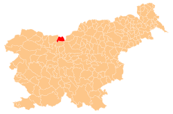
 Location of the Municipality of Jezersko in Slovenia |
|
| Coordinates: 46°23′34″N 14°29′51″E / 46.39278°N 14.49750°ECoordinates: 46°23′34″N 14°29′51″E / 46.39278°N 14.49750°E | |
| Country |
|
| Government | |
| • Mayor | Jurij Rebolj |
| Area | |
| • Total | 68.8 km2 (26.6 sq mi) |
| Population (2002) | |
| • Total | 638 |
| • Density | 9.3/km2 (24/sq mi) |
| Time zone | CET (UTC+01) |
| • Summer (DST) | CEST (UTC+02) |
The Municipality of Jezersko (Slovene: Občina Jezersko ![]() pronunciation ) is a municipality in northern Slovenia. Since 1995, Jezersko was part of Preddvor and became an independent municipality in 1998. Originally located in the historic region of Carinthia, it became part of the Upper Carniola Statistical Region in 2005.
pronunciation ) is a municipality in northern Slovenia. Since 1995, Jezersko was part of Preddvor and became an independent municipality in 1998. Originally located in the historic region of Carinthia, it became part of the Upper Carniola Statistical Region in 2005.
Jezersko is located in the remote Kokra Valley in the Kamnik–Savinja Alps, south of the Seeberg Saddle mountain pass and the border with the Austrian state of Carinthia.
The name of the area derives from a glacial lake near the settlement of Zgornje Jezersko that started to disappear after an earthquake in 1348. However, it was still described by Johann Weikhard von Valvasor in 1689 as a large lake. It gave the area its German name Seeland (literally "lake land", first recorded as Seelant in 1496), and its Slovene equivalent Jezersko, which came into use at the end of the 19th century. A document from 1391 mentions the church of "St. Oswald by the Lake" (Sv. Ožbolt pri Jezeru).
...
Wikipedia
