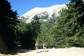
Mt. Taygetos
| Mount Taygetus | |
|---|---|
|
Ταΰγετος Profitis Ilias (HP) |
|
 |
|
| Highest point | |
| Elevation | 2,404 m (7,887 ft) |
| Prominence | 2,344 m (7,690 ft) |
| Listing | Ultra |
| Coordinates | 36°57′14″N 22°21′08″E / 36.95389°N 22.35222°ECoordinates: 36°57′14″N 22°21′08″E / 36.95389°N 22.35222°E |
| Geography | |
| Location | Peloponnese, Greece |
| Climbing | |
| Easiest route | Hike, some rock scramble |
The Taygetus, Taugetus, Taygetos or Taÿgetus (Greek: Ταΰγετος, translit. Taygetos) is a mountain range in the Peloponnese peninsula in Southern Greece. The highest mountain of the range is Mount Taygetus, also known as the "Profitis Ilias", or "Prophet Elias". The name is one of the oldest recorded in Europe, appearing in the Odyssey. In classical mythology, it was associated with the nymph Taygete. During Byzantine times and up until the 19th century, the mountain was also known as Pentadaktylos (Πενταδάκτυλος; Greek for five-fingered, a common name during that period).
The Taygetus Massif is about 100 km (62 mi) long, extending from the center of the Peloponnese to Cape Matapan, its southernmost extremity. It contains the tallest mountain in the Peloponnese, the Profitis Ilias summit, reaching 2,404 m (7,887 ft); this is probably the classical Mount Taléton mentioned by Pausanias. The summit is an ultra prominent peak. It is prominent above the Isthmus of Corinth, which separating the Peloponnese from mainland Greece, rises only to approximately 60 m (200 ft). Numerous creeks wash down from the mountains and the Evrotas river has some of its headwaters in the northern part of the range. The western side of the massif houses the headwaters of the Viros gorge, which carries winter snowmelt down the mountain, emptying into the Messenian Gulf in the town of Kardamili.
Taygetus overlooks the cities of Sparta and Kalamata, whose skyline it dominates. The mountain range lies within the prefectures of Arcadia, Laconia and Messenia. Taygetus is crossed by Greek National Road 82, which links Kalamata to Sparta and separates Northern Taygetus from the Central Range. The Rindomo Gorge separates the Central Range from Southern Taygetos. The section of Taygetus that forms the backbone of the Mani Peninsula is also known as Saggias, and is often not considered part of Taygetus. The central part of the mountain range is commonly called "Skoteini Plevra", which means "the dark side" because the villages located there do not receive as much sunshine in the early morning and the late afternoon hours.
...
Wikipedia

