Msambweni
| Msambweni | |
|---|---|
| Town and constituency | |

View of the coast from Msambweni Beach Hotel
|
|
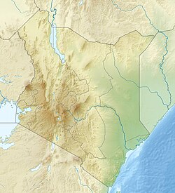
| Location of Msambweni | |
| Coordinates: 4°28′S 39°29′E / 4.47°S 39.48°ECoordinates: 4°28′S 39°29′E / 4.47°S 39.48°E | |
| Country |
|
| County | Kwale County |
| Population (2009) | |
| • Town and constituency | 288,393 (constituency) |
| • Metro | 11,985 |
| Time zone | EAT (UTC+3) |
Msambweni (meaning "land of Msambwe") in Swahili) is a small fishing town and constituency in Kwale County of southeastern Kenya, formerly in Kwale District of Coast Province. The origin of the name, Msambwe (plural Misambwe) is a hardy and wild fruits (sambwe) tree indigenous to Msambweni. A few remnants of the Msambwe trees are still existing at Mkunguni Beach, Sawa Sawa Village. By road, Msambweni is 55.4 kilometres (34.4 mi) south of Mombasa and 46.5 kilometres (28.9 mi) northeast of Lunga Lunga on the Tanzanian border. As of 2009, the town had a population of 11,985 people.
Fishing is the primary source of income, although coconut palm, buxa coloring,cashew nuts and fruits are produced for trade. Because of its reef and extensive beaches, the snorkeling industry is gaining in popularity in Msambweni, and holiday cottages and hotels have sprung up in the area, such as the Msambweni Beach House. The town is noted for its leprosarium and contains the Msambweni District Hospital. The Koromojo Dam is immediately north of the town.
By road, Msambweni is 55.4 kilometres (34.4 mi) south of Mombasa, 46.9 kilometres (29.1 mi) southeast of Kwale, and 46.5 kilometres (28.9 mi) northeast of Lunga Lunga on the Tanzanian border. It lies along the A14 road (Ukunda-Ramisi Road) between the villages of Ukunda and Shimoni.
Msambweni forms a constituency that starts from the Mwachema River at the border of Tiwi and Diani Beach to the north, and down to Vanga at the border of Kenya and Tanzania to the south.
...
Wikipedia

