Mozia

Motya
|
|
| Location | Marsala, Sicily, Italy |
|---|---|
| Coordinates | 37°52′06″N 12°28′07″E / 37.86833°N 12.46861°ECoordinates: 37°52′06″N 12°28′07″E / 37.86833°N 12.46861°E |
| Type | Settlement |
| Site notes | |
| Condition | In ruins |
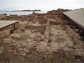
Motya (Ancient Greek: Μοτύη, Μοτύα; Italian: Mozia, Mothia; Sicilian: Mozzia), was an ancient and powerful city on an island off the west coast of Sicily, between Drepanum (modern Trapani) and Lilybaeum (modern Marsala). The island was renamed San Pantaleo in the 11th century by Basilian monks. It lies in the Stagnone Lagoon, and is within the comune of Marsala.
Though the city was started by earlier cultures, it was settled for nearly four centuries by the Phoenicians.
The island is nearly 850 metres (2,790 ft) long and 750 metres (2,460 ft) wide, and about 1 kilometre (0.62 mi) (six stadia) from the mainland of Sicily. It was joined to the mainland in ancient times by an artificial causeway (paved road), by which chariots with large wheels could reach the town.
The remarkable and exquisite Motya Charioteer marble sculpture found in 1979 is world famous and is on display at the local Giuseppe Whitaker museum.
The foundation of the city probably dates from the eighth century BC, about a century after the foundation of Carthage in Tunisia. It was originally a colony of the Phoenicians, who were fond of choosing similar sites, and probably in the first instance merely a commercial station or emporium, but gradually rose to be a flourishing and important town. The Phoenicians transformed the inhospitable island, which they called Motya, into one of the most affluent cities of its time, naturally defended by the lagoon as well as high defensive walls. Ancient windmills and salt pans were used for evaporation, salt grinding and refinement, and to maintain the condition of the lagoon and island itself. Recently the mills and salt pans (called the Ettore Infersa) have been restored by the owners and opened to the public.
...
Wikipedia

