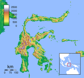
Mount Sempu
| Mount Sempu | |
|---|---|
|
Sulawesi, Indonesia
|
|
| Highest point | |
| Elevation | 1,549 m (5,082 ft) |
| Listing | Ribu |
| Coordinates | 1°07′48″N 124°45′29″E / 1.13°N 124.758°ECoordinates: 1°07′48″N 124°45′29″E / 1.13°N 124.758°E |
| Geography | |
| Location | Sulawesi, Indonesia |
| Geology | |
| Mountain type | Caldera |
| Last eruption | Unknown |
Mount Sempu in the northern arm of Sulawesi, Indonesia, contains a 3 km wide of caldera. A maar, called Kawah Masem, was formed in the south-west of the caldera and contains a crater lake. Sulfur deposits have been extracted from the maar since 1938. Historical records, however, are unknown from the volcano.
...
Wikipedia

