Mount Scenery
| Mount Scenery | |
|---|---|

Saba with Mount Scenery's peak in the clouds
|
|
| Highest point | |
| Elevation | 887 m (2,910 ft) |
| Prominence | 887 m (2,910 ft) |
| Listing | Country high point |
| Coordinates | 17°38′06″N 63°14′21″W / 17.63500°N 63.23917°WCoordinates: 17°38′06″N 63°14′21″W / 17.63500°N 63.23917°W |
| Geography | |
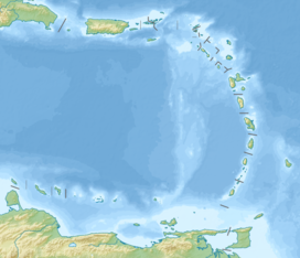
| Location | Saba, Caribbean Netherlands |
| Geology | |
| Mountain type | Stratovolcano with lava dome |
| Last eruption | 1640 |
Mount Scenery is a potentially active volcano in the Caribbean Netherlands. Its lava dome forms the summit of the Saba island stratovolcano. At an elevation of 887 m (2,910 ft), it is the highest point in both the Kingdom of the Netherlands, and, since the dissolution of the Netherlands Antilles on 10 October 2010, the highest point in the Netherlands proper.
The Saba volcano is potentially dangerous; the latest eruption was in or around the year 1640 and included explosions and pyroclastic flows.
Street in the village of Windwardside with Mount Scenery in the background.
The peak as seen from Windwardside.
Mount Scenery in the clouds.
View over Windwardside and Mount Scenery.
View from Mount Scenery with Windwardside in the front.
...
Wikipedia

