Mount Saint Mary
| Mount Saint Mary | |
|---|---|
| Šmarna gora | |

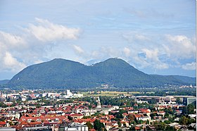
View of Mount Saint Mary from Castle Hill
|
|
| Highest point | |
| Elevation | 676 m (2,218 ft) |
| Coordinates | 46°7′47″N 14°27′49″E / 46.12972°N 14.46361°ECoordinates: 46°7′47″N 14°27′49″E / 46.12972°N 14.46361°E |
| Geography | |
|
|
|
Mount Saint Mary (Slovene: Šmarna gora, German: Großkahlenberg), originally known as Holm, is an inselberg in the north of Ljubljana, the capital of Slovenia. The mountain is part of the city's Šmarna Gora District. It is the highest hill in the city and a popular hiking destination.
The mountain, with the shape of a two-hump camel or a woman's breasts, has two peaks: Mount Saint Mary (Šmarna gora; 669 metres, 2,195 ft) to the west and Grmada (676 m, 2,218 ft) to the east. In clear conditions, the mountain offers a wide view. To the north, it is possible to see Mount Triglav and Mount Stol, and in the southern directions Mount Krim, Mount Snežnik, and Trdina Peak (Slovene: Trdinov vrh). The nearby hills are Bare Hill (Golo brdo), Tošč Face (Toško čelo), Rožnik, and Rašica.
The hill is surrounded by the villages of Vikrče and Spodnje Pirniče to the west, Zavrh pod Šmarno Goro to the north, and the former villages (now part of Ljubljana) of Šmartno pod Šmarno Goro and Tacen to the southeast.
...
Wikipedia

