Mount Davidson (California)
| Mount Davidson | |
|---|---|

Mount Davidson as seen from the Twin Peaks.
|
|
| Highest point | |
| Elevation | 928 ft (283 m) NAVD 88 |
| Listing |
San Francisco Hill California county high points 57th |
| Coordinates | 37°44′18″N 122°27′12″W / 37.7382643°N 122.4533047°WCoordinates: 37°44′18″N 122°27′12″W / 37.7382643°N 122.4533047°W |
| Geography | |
| Location | San Francisco, California, United States |
| Topo map | USGS San Francisco South |
| Climbing | |
| Easiest route | Hike |
| Mount Davidson Park | |
|---|---|
| Type | Municipal (San Francisco) |
| Location | San Francisco |
| Coordinates | 37°44′18″N 122°27′18″W / 37.7382643°N 122.4549715°W |
| Area | 38 acres (15 ha) |
| Created | 1920s |
| Status | Open all year |
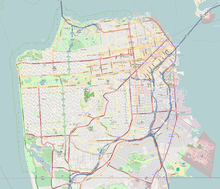
Mount Davidson is the highest natural point in San Francisco, California, with an elevation of 928 feet (283 m). It is located near the geographical center of the city, south of Twin Peaks and Portola Drive and to the west of Diamond Heights and Glen Park. It dominates the southeastern view from most of Portola Drive. It is one of San Francisco's many hills and one of its original "Seven Hills".
Mount Davidson's most notable feature, aside from its height, is the 103-foot (31.4 m) concrete cross situated on the crest of the hill. It is the site of a yearly prayer service, performed on Easter, when the cross is illuminated.
Mount Davidson Park tops the hill – excluding the land at the summit, which is privately owned. The parkland portion is located between Myra Way (east), Dalewood Way (southwest), and Juanita Way (north). Public transportation is provided by the 36 Teresita Muni line, which stops at the Dalewood Way and Myra Way entrance to the park.
The residential neighborhoods around Mount Davidson Park are Miraloma Park to the east and Westwood Highlands and Sherwood Forest to the southwest.
Adolph Sutro purchased the land in 1881. Under his ownership, what was then called "Blue Mountain" was renamed "Mount Davidson," for George Davidson, a charter member of the Sierra Club. Sutro's appraiser, A.S. Baldwin, bought this land from Sutro's heirs in 1911, along with much of the land immediately north and south of Mount Davidson. Baldwin began plans for development of Forest Hill, St. Francis Wood, Westwood Park, Balboa Terrace, and Monterey Heights.
...
Wikipedia


