Mount Agung
| Mount Agung | |
|---|---|

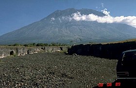
Mount Agung in 1989
|
|
| Highest point | |
| Elevation | 3,031 m (9,944 ft) |
| Prominence | 3,031 m (9,944 ft) Ranked 87th |
| Isolation | 105 kilometres (65 mi) |
| Listing |
Ultra Ribu |
| Coordinates | 8°20′27″S 115°30′12″E / 8.34083°S 115.50333°ECoordinates: 8°20′27″S 115°30′12″E / 8.34083°S 115.50333°E |
| Naming | |
| Translation | Paramount, The Great Mountain |
| Geography | |
| Geology | |
| Mountain type | Stratovolcano |
| Last eruption | 1963 to 1964 |
| Climbing | |
| Easiest route | Hike |
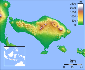
Mount Agung or Gunung Agung is a volcano in Bali, Indonesia. This stratovolcano is the highest point on the island. It dominates the surrounding area, influencing the climate. The clouds come from the west and Agung takes their water so that the west is lush and green while the east dry and barren.
The Balinese believe that Mount Agung is a replica of Mount Meru, the central axis of the universe. One legend holds that the mountain is a fragment of Meru brought to Bali by the first Hindus. The most important temple on Bali, Pura Besakih, is located high on the slopes of Gunung Agung.
Gunung Agung last erupted in 1963-1964 and is still active, with a large and very deep crater which occasionally belches smoke and ash. From a distance, the mountain appears to be perfectly conical.
From the peak of the mountain, it is possible to see the peak of Mount Rinjani on the island of Lombok, although both mountains are frequently covered in clouds.
On February 18, 1963, local residents heard loud explosions and saw clouds rising from the crater of Mount Agung. On February 24, lava began flowing down the northern slope of the mountain, eventually traveling 7 km in the next 20 days. On March 17, the volcano erupted (VEI 5), sending debris 8 to 10 km into the air and generating massive pyroclastic flows. These flows devastated numerous villages, killing approximately 1500 people. Cold lahars caused by heavy rainfall after the eruption killed an additional 200. A second eruption on May 16 led to pyroclastic flows that killed another 200 inhabitants.
The lava flows missed, sometimes by mere yards, the Mother Temple of Besakih. The saving of the temple is regarded by the Balinese people as miraculous and a signal from the gods that they wished to demonstrate their power but not destroy the monument the Balinese faithful had erected.
...
Wikipedia

