Moultonborough
| Moultonborough, New Hampshire | ||
|---|---|---|
| Town | ||
|
||
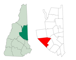
 Location in Carroll County, New Hampshire |
||
| Coordinates: 43°45′18″N 71°23′47″W / 43.75500°N 71.39639°WCoordinates: 43°45′18″N 71°23′47″W / 43.75500°N 71.39639°W | ||
| Country | United States | |
| State | New Hampshire | |
| County | Carroll | |
| Incorporated | 1777 | |
| Government | ||
| • Board of Selectmen | Christopher P. Shipp, Chair Russell C. Wakefield Paul T. Punturieri Josiah H. Bartlett Jean M. Beadle |
|
| • Town Administrator | Walter P. Johnson | |
| Area | ||
| • Total | 74.6 sq mi (193.2 km2) | |
| • Land | 59.5 sq mi (154.0 km2) | |
| • Water | 15.1 sq mi (39.2 km2) 20.29% | |
| Elevation | 610 ft (186 m) | |
| Population (2010) | ||
| • Total | 4,044 | |
| • Density | 54/sq mi (21/km2) | |
| Time zone | Eastern (UTC-5) | |
| • Summer (DST) | Eastern (UTC-4) | |
| ZIP code | 03254 | |
| Area code(s) | 603 | |
| FIPS code | 33-49380 | |
| GNIS feature ID | 0873671 | |
| Website | www.Moultonborough.org | |
Moultonborough is a town in Carroll County, New Hampshire, United States. The population was 4,044 at the 2010 census. Moultonborough is bounded in part by Lake Winnipesaukee in the southwest and Squam Lake in the northwest corner. The town includes the census-designated place of Suissevale and the community of Lees Mill.
The first settlers were grantees from Hampton, among whom were at least sixteen Moultons, giving the town its name. Colonel Jonathan Moulton was considered to be one of the richest men in the province at the start of the American Revolution. Moultonborough was chartered in 1763 by Colonial Governor Benning Wentworth, and at the time was described as being near the "Winnepisseoky Pond." It was officially incorporated in 1777.
Moultonborough is home to the "Castle in the Clouds", an estate set in the Ossipee Mountains. Thomas Gustave Plant made a fortune manufacturing shoes, bought 6,300 acres (25 km2) and hired the Boston architectural firm of J. Williams Beal & Sons to design "Lucknow," a stone mansion built between 1913 and 1914. The property, with sweeping views of Lake Winnipesaukee, is a popular tourist attraction.
According to the United States Census Bureau, the town has a total area of 74.6 square miles (193 km2), of which 59.5 square miles (154 km2) is land and 15.1 square miles (39 km2) is water, comprising 20.29% of the town. A large portion of the town is located along Lake Winnipesaukee, the largest lake in New Hampshire. Moultonborough Bay, an 8-mile-long (13 km) arm of the lake, extends from the southern corner of the town towards the center of the town. Moultonborough Neck forms a peninsula between Moultonborough Bay and Center Harbor to the southwest. Long Island, the largest island in Lake Winnipesaukee, is connected to Moultonborough Neck by a bridge. The community of Suissevale, a census-designated place, occupies part of the northeast shore of Moultonborough Bay. Inland from Winnipesaukee, Lake Kanasatka is in the west part of the town. Red Hill, elevation 2,029 feet (618 m) above sea level, is in the northwest. Mount Shaw, elevation 2,990 feet (911 m), part of the Ossipee Mountains and the highest point in Moultonborough, is in the east.
...
Wikipedia

