Morvah
Morvah
|
|
|---|---|
 Morvah chapel with Anglican Church in the background |
|
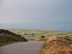
 Plain in Morvah with the Atlantic beyond from above Trevowhan |
|
| Morvah shown within Cornwall | |
| Population | 49 (2011) |
| OS grid reference | SW402353 |
| Unitary authority | |
| Ceremonial county | |
| Region | |
| Country | England |
| Sovereign state | United Kingdom |
| Post town | PENZANCE |
| Postcode district | TR20 |
| Dialling code | 01736 |
| Police | Devon and Cornwall |
| Fire | Cornwall |
| Ambulance | South Western |
| EU Parliament | South West England |
| UK Parliament | |
Morvah is a civil parish and village on the Penwith peninsula in west Cornwall, England, United Kingdom.
The village is centred approximately eight miles (13 km) west-southwest of St Ives and 5 1⁄2 miles (8.9 km) north-west of Penzance. Morvah parish encompasses the settlements of Chypraze and Rosemergy and is bounded by the parishes of St. Just to the west, Zennor to the north-east, Madron to the south and by the sea in the north. The parish consists of 1,270 acres (5 km2) of land, 1-acre (0.40 ha) of water and 14 acres (5.7 ha) of foreshore.
The small churchtown of Morvah lies along the B3306 road which connects St Ives to the A30 road and consists of housing, an art gallery, a dairy farm and the parish church, St Bridget's. The chancel and nave were rebuilt in 1828, leaving the two-staged, unbuttressed west tower from the 14th-century.
Morvah lies within the Cornwall Area of Outstanding Natural Beauty (AONB). Almost a third of Cornwall has AONB designation, with the same status and protection as a National Park. The South West Coast Path, which follows the coast of south west England from Somerset to Dorset passes by on the cliffs to the north of Morvah churchtown.
Evidence of a settlement at Morvah in the early Middle Ages is in the form of an inscribed stone known as the Mên Scryfa; it is a memorial to one 'Rialobranus son of Cunovalus', located in a field on a moor about three kilometres from the village. It was first described in a letter written by the antiquary Edward Lhwyd. The inscription has been dated from the fifth to the eighth century., but more firmly and authoritatively dated to the middle third of the 6th century by Professor Charles Thomas (And Shall these Mute Stones Speak, University of Wales Press 1994). In fact, this inscribed stone stands in the parish of Madron, a good mile east of Morvah parish. The finest antiquities of Morvah parish are the Neolithic dolmen of Chûn Quoit (c. 3500 BC) and the nearby Iron Age hillfort (c. 300 BC) of Chûn Castle (half of which is also in Madron parish), as well as the Late Iron Age settlement of four distinctively local courtyard houses at Croftoe. These include a rare "semi-detached" dwelling.
...
Wikipedia

