Morningside (Miami)
| Upper Eastside | |
|---|---|
| Neighborhood of Miami | |

A MiMo restaurant on Biscayne Boulevard in the Upper Eastside. The Upper Eastside is famous for its post war MiMo architecture, and is home to the MiMo Biscayne Boulevard Historic District.
|
|
| Nickname(s): The Northeast, The Boulevard | |
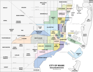
 The Upper Eastside neighborhood within the City of Miami |
|
| Coordinates: 25°49′44″N 80°11′06″W / 25.829°N 80.185°W | |
| Country | United States |
| State | Florida |
| County | Miami-Dade County |
| City | Miami |
| Settled | 1909 |
| Annexed into the City of Miami | 1924 |
| Subdistricts of the Upper East Side |
Neighborhoods list
|
| Government | |
| • City of Miami Commissioner | Marc Sarnoff |
| • Miami-Dade Commissioner | Audrey Edmonson |
| • House of Representatives | Cynthia Stafford (D) |
| • State Senate | Gwen Margolis (D) |
| • U.S. House | Bill Nelson (D) |
| Population (2010) | |
| • Total | 12,525 |
| • Density | 6,509/sq mi (2,513/km2) |
| Time zone | EST (UTC-05) |
| ZIP Code | 33137, 33138 |
| Area code(s) | 305, 786 |
| Website | Upper East Side neighborhood |
The Upper Eastside (alternatively spelled East Side and commonly referred to as Northeast Miami) is a neighborhood in Miami, Florida, United States. It is north of Edgewater, east of Little Haiti, south of the village of Miami Shores, and sits on Biscayne Bay. In geographical order from south to north and east to west, it contains the subdivisions of Magnolia Park, Bay Point, Morningside, Bayside, Belle Meade, Shorecrest, and Palm Grove. The MiMo District in the area is host to many art galleries, shops and restaurants.
The Upper East Side is primarily a residential neighborhood, composed largely of historic single-family homes from the 1920s, 1930s, and 1940s, with Biscayne Boulevard running along the center of the neighborhood with mid-rise and high-rise office towers, hotels, and apartments. The MiMo Historic District runs along Biscayne Boulevard, and includes a large number of MiMo hotels from the 1950s and 1960s, that have been preserved, and have recently begun to be renovated, and turned into stores, restaurants and boutique hotels.
Magnolia Park lies east of Biscayne Boulevard between NE 37th Street (next to the Julia Tuttle Causeway) and NE 39th Street. Bay Point is east of the Boulevard, north of NE 39th Street and south of NE 50th Terrace. Morningside lies east of the Boulevard from NE 50th Terrace to NE 60th Street. Bayside is east of the Boulevard from NE 61st Street to NE 72nd Street. Belle Meade is east of the Boulevard from NE 72nd Terrace to NE 77th Terrace. Shorecrest is east of the Boulevard from NE 78th Street to NE 87th Street. Palm Grove is west of Biscayne Boulevard between NE 54th Street and NE 77th Street Road (i.e.: south of the Little River).
The area between NE 37th Street and NE 54th Street from Biscayne Boulevard westward one block to Federal Highway is not officially part of any of these neighborhoods but is nevertheless part of the UES. Similarly, the area from the Little River north to the city limits and between Biscayne Boulevard on the east and the Little River and the Village of El Portal on the west is not part of any of the aforementioned neighborhoods but is part of the UES.
...
Wikipedia
