Moraga
| Town of Moraga | |
|---|---|
| Town | |

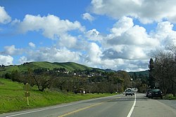
Moraga Way view toward Moraga Road
|
|
 Location in Contra Costa County and the state of California |
|
| Location in the United States | |
| Coordinates: 37°50′06″N 122°07′47″W / 37.83500°N 122.12972°WCoordinates: 37°50′06″N 122°07′47″W / 37.83500°N 122.12972°W | |
| Country | USA |
| State |
|
| County | Contra Costa |
| Incorporated | November 13, 1974 |
| Government | |
| • Mayor | Roger Wykle |
| • State Senator | Steve Glazer (D) |
| • State Assembly | Catharine Baker (R) |
| • U. S. Congress | Mark DeSaulnier (D) |
| Area | |
| • Total | 9.442 sq mi (24.455 km2) |
| • Land | 9.433 sq mi (24.432 km2) |
| • Water | 0.009 sq mi (0.023 km2) 0.09% |
| Elevation | 499 ft (152 m) |
| Population (2010) | |
| • Total | 16,016 |
| • Density | 1,700/sq mi (650/km2) |
| Time zone | PST (UTC-8) |
| • Summer (DST) | PDT (UTC-7) |
| ZIP codes | 94556, 94570, 94575 |
| Area code(s) | 925 |
| FIPS code | 06-49194 |
| GNIS feature IDs | 1659171, 2413013 |
| Website | www |
| Moraga | ||||||||||||||||||||||||||||||||||||||||||||||||||||||||||||
|---|---|---|---|---|---|---|---|---|---|---|---|---|---|---|---|---|---|---|---|---|---|---|---|---|---|---|---|---|---|---|---|---|---|---|---|---|---|---|---|---|---|---|---|---|---|---|---|---|---|---|---|---|---|---|---|---|---|---|---|---|
| Climate chart () | ||||||||||||||||||||||||||||||||||||||||||||||||||||||||||||
|
||||||||||||||||||||||||||||||||||||||||||||||||||||||||||||
|
||||||||||||||||||||||||||||||||||||||||||||||||||||||||||||
| J | F | M | A | M | J | J | A | S | O | N | D |
|
6.1
53
35
|
4.3
58
38
|
3.7
62
39
|
2
67
42
|
0.6
72
47
|
0.2
77
51
|
0.1
82
54
|
0.1
81
54
|
0.3
81
52
|
1.6
73
46
|
3.6
62
40
|
5
54
36
|
| Average max. and min. temperatures in °F | |||||||||||
| Precipitation totals in inches | |||||||||||
| Source: <http://www.wrcc.dri.edu/cgi-bin/cliMAIN.pl?ca7661> | |||||||||||
| Metric conversion | |||||||||||
|---|---|---|---|---|---|---|---|---|---|---|---|
| J | F | M | A | M | J | J | A | S | O | N | D |
|
155
12
2
|
109
15
3
|
95
17
4
|
50
19
5
|
16
22
8
|
4.1
25
Wikipedia
...
| ||||||

