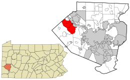
Moon Township, Allegheny County, Pennsylvania
| Moon Township, Allegheny County, Pennsylvania |
|
|---|---|
| Township | |

The house at Robin Hill Park, a large community center area in Moon Township
|
|
 Location in Allegheny County and state of Pennsylvania |
|
| Coordinates: 40°31′N 80°14′W / 40.517°N 80.233°WCoordinates: 40°31′N 80°14′W / 40.517°N 80.233°W | |
| Country | United States |
| State | Pennsylvania |
| County | Allegheny |
| Incorporated | 1788 |
| Government | |
| • Type | Council |
| • Chairman | Jim Vitale |
| Elevation | 1,775 ft (358 m) |
| Population (2015) | |
| • Total | 25,562 |
| Time zone | Eastern (EST) (UTC-5) |
| • Summer (DST) | EDT (UTC-4) |
| ZIP code | 15108 |
| Area code(s) | 412, 724 |
| Website | Moon Township |
Moon Township is a township along the Ohio River in Allegheny County, Pennsylvania, United States. Moon is a part of the Pittsburgh Metro Area and is located 12 miles (19 km) northwest of Pittsburgh. The origin of its name is unknown; historians suggest it was derived from a crescent-shaped bend in the river. The population was 24,185 at the 2010 census.
The initial settlement of Moon Township was a direct result of the westward expansion of English settlers and traders who arrived in the Ohio Valley in the early to mid-18th century. During the French and Indian War (Seven Years' War), the Iroquois, which controlled the land for hunting grounds through right of conquest, ceded large parcels of southwestern Pennsylvania lands through treaty or abandonment to settlers; in some cases, the land was already occupied by squatters who were to be forced off of the land.
In the face of this turmoil, Indian settlements of the south bank of the Ohio River typically relocated to more populous areas of the north bank in the current locales of Sewickley, Aliquippa and Ambridge.
On the southern banks of the Ohio, political disputes among settlers clouded the disposition of lands. Generally, the Pennsylvania Land Office apportioned land to owners through grants. But, some of the land encompassing what is now the Coraopolis Heights, Thorn Run valley, and Narrows Run valley were claimed through the process of "Tomahawk Improvements", a non-specific and oftentimes contested method. Settlement processes were often convoluted because of differences among land policies of the several colonies claiming the land, specifically Pennsylvania and Virginia.
Each colony had its own means of either granting or restricting settlement opportunities. Each settler claiming land in what is now Moon Township had to go through a multi-level process of application for grant, warrant of property, and survey to ensure the physical boundaries of the property, and patent approval whereby the applicant paid for the land and title was conferred.
...
Wikipedia
