Montricher, Switzerland
| Montricher | ||
|---|---|---|

Montricher village
|
||
|
||
| Coordinates: 46°36′N 06°22′E / 46.600°N 6.367°ECoordinates: 46°36′N 06°22′E / 46.600°N 6.367°E | ||
| Country | Switzerland | |
| Canton | Vaud | |
| District | Morges | |
| Government | ||
| • Mayor |
Syndic Michel Desmeules |
|
| Area | ||
| • Total | 25.98 km2 (10.03 sq mi) | |
| Elevation | 752 m (2,467 ft) | |
| Population (Dec 2015) | ||
| • Total | 958 | |
| • Density | 37/km2 (96/sq mi) | |
| Demonym(s) | Les Montélets | |
| Postal code | 1147 | |
| SFOS number | 5492 | |
| Surrounded by | L'Isle, Mauraz, Pampigny, Berolle, Mollens (VD), Le Chenit, L'Abbaye | |
| Website |
www Profile (French), SFSO statistics |
|
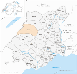
Montricher is a municipality of the canton of Vaud in Switzerland, located in the district of Morges.
Montricher is first mentioned in 1049 as Mons Richarius. In 1301 it was mentioned as Montricher.
Montricher has an area, as of 2009[update], of 25.98 square kilometers (10.03 sq mi). Of this area, 10.04 km2 (3.88 sq mi) or 38.6% is used for agricultural purposes, while 14.91 km2 (5.76 sq mi) or 57.4% is forested. Of the rest of the land, 0.79 km2 (0.31 sq mi) or 3.0% is settled (buildings or roads), 0.02 km2 (4.9 acres) or 0.1% is either rivers or lakes and 0.19 km2 (0.073 sq mi) or 0.7% is unproductive land.
Of the built up area, housing and buildings made up 1.0% and transportation infrastructure made up 1.5%. Out of the forested land, 53.9% of the total land area is heavily forested and 3.5% is covered with orchards or small clusters of trees. Of the agricultural land, 17.3% is used for growing crops and 9.4% is pastures and 11.6% is used for alpine pastures. All the water in the municipality is flowing water.
The municipality was part of the Cossonay District until it was dissolved on 31 August 2006, and Montricher became part of the new district of Morges.
The municipality is located in the forested foothills of the Jura Mountains. The municipality includes the peak of Mont Tendre, which is the highest peak in the Swiss Jura Mountains. It has an elevation of 1,679 m (5,509 ft).
The blazon of the municipal coat of arms is Argent, in Chief Gules three Escallops Or.
Montricher has a population (as of December 2015[update]) of 958. As of 2008[update], 8.0% of the population are resident foreign nationals. Over the last 10 years (1999–2009 ) the population has changed at a rate of 14.9%. It has changed at a rate of 11.4% due to migration and at a rate of 3% due to births and deaths.
...
Wikipedia


