Monticello, Florida
| Monticello, Florida | |
|---|---|
| City | |

Monticello City Hall
|
|
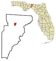
 Location in Jefferson County and the state of Florida |
|
| Coordinates: 30°32′41″N 83°52′2″W / 30.54472°N 83.86722°WCoordinates: 30°32′41″N 83°52′2″W / 30.54472°N 83.86722°W | |
| Country |
|
| State |
|
| County | Jefferson |
| Government | |
| • Mayor | Tom Vogelgesang |
| Area | |
| • Total | 3.4 sq mi (8.8 km2) |
| • Land | 3.4 sq mi (8.8 km2) |
| • Water | 0 sq mi (0 km2) |
| Elevation | 233 ft (71 m) |
| Population (2000) | |
| • Total | 2,533 |
| • Density | 745/sq mi (287.8/km2) |
| Time zone | Eastern (EST) (UTC-5) |
| • Summer (DST) | EDT (UTC-4) |
| ZIP codes | 32344-32345 |
| Area code(s) | 850 |
| FIPS code | 12-46500 |
| GNIS feature ID | 0287080 |
Monticello is a city in Jefferson County, Florida, United States. The population was 2,533 at the 2000 census. As of 2004, the population recorded by the U.S. Census Bureau is 2,572. It is the county seat of Jefferson County. The city is named after Monticello, the estate of the county's namesake, Thomas Jefferson.
Monticello is home to Indian mounds and many historic buildings, including the Perkins Opera House and Monticello Old Jail Museum.
Monticello is located at 30°32′41″N 83°52′02″W / 30.544612°N 83.867321°W.
According to the United States Census Bureau, the city has a total area of 3.4 square miles (8.8 km2), all land. This is also where the highest confirmed recorded temperature in Florida occurred, at 109 °F.
As of the census of 2000, there were 2,533 people, 973 households, and 664 families residing in the city. The population density was 749.4 people per square mile (289.3/km²). There were 1,088 housing units at an average density of 321.9 per square mile (124.3/km²). The racial makeup of the city was 47.06% White, 50.85% African American, 0.12% Native American, 0.59% Asian, 0.08% Pacific Islander, 0.43% from other races, and 0.87% from two or more races. Hispanic or Latino of any race were 1.30% of the population.
...
Wikipedia
