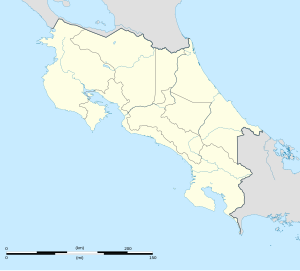
Monteverde
| Monteverde Costa Rica | |
|---|---|

Commercial street in Santa Elena
|
|
| Location in Costa Rica | |
| Coordinates: 10°18′51.32″N 84°49′30.08″W / 10.3142556°N 84.8250222°WCoordinates: 10°18′51.32″N 84°49′30.08″W / 10.3142556°N 84.8250222°W | |
| Country |
|
| Province | Puntarenas |
| Distrito | Monteverde |
| Population | |
| • Total | 6,500 |
| Area code(s) | +506 |
Monteverde, Costa Rica is a small community in Puntarenas, Costa Rica, located in the Cordillera de Tilarán. Roughly a four-hour drive from the Central Valley, Monteverde is considered a major ecotourism destination in Costa Rica. The area is host to the Monteverde Cloud Forest Reserve and numerous other reserves, which draw considerable numbers of tourists and naturalists.
National Geographic has called the Monteverde Cloud Forest Biological Reserve "the jewel in the crown of cloud forest reserves".Newsweek has declared Monteverde the world's #14 Place to Remember Before it Disappears." By popular vote in Costa Rica, Monteverde was enshrined as one of the Seven Natural Wonders of Costa Rica, along with Isla del Coco, Volcán Arenal, Cerro Chirripó, Río Celeste, Tortuguero, and Volcán Poás.
This article deals with Monteverde and its surrounding zone. This includes the larger town and tourism hub Santa Elena, as well as the nearby cluster of homes and businesses known as Cerro Plano, along with numerous reserves and attractions on the periphery of the town.
Resting roughly at 1,400 metres (4,600 ft) above sea level, Monteverde is misty, humid, and windy, with a mean annual temperature of 18 °C (64 °F) (Nadkarni 2000: 17). Annual rainfall averages around 3,000 millimetres (118 in). Humidity oscillates between 74% and 97% (Nadkarni 2000: 34).
Various pre-Columbian artifacts testify to the longtime occupancy of the Monteverde region by a small population of Clovis Native Americans, who once farmed in villages circa 3000 BC. Between roughly 3300 BC to 2000 BC, the nearby tribes of the Arenal area experienced a population decline. These nearby tribes re-established villages in the region between 2000 BC to 500 BC. Agriculture intensified in the 500 BC to AD 300 period, with chiefdom societies replacing small tribal societies. Intense deforestation accompanied horticulture, and stone foundations dating to this period can be found. Jade objects became prominent characteristics of these villages. From AD 300 to 800, complex chiefdoms supplanted simpler chiefdoms and more intricate villages appear, with cemeteries, public squares, gold-work and inter-tribal trade and conflict. Around 1300, a general decline in population occurred, possibly due to Arenal Volcano's increased activity.
...
Wikipedia

