Monte Curral
| Monte Curral | |
|---|---|

Monte Curral from Rodovía do Sal (Sal Island Highway) with its communication facilities and its airport's control tower
|
|
| Highest point | |
| Elevation | 109 m (358 ft) |
| Listing | List of mountains in Cape Verde |
| Coordinates | 16°45′26″N 22°56′34″W / 16.75722°N 22.94278°WCoordinates: 16°45′26″N 22°56′34″W / 16.75722°N 22.94278°W |
| Geography | |
|
Monte Curral in the Interior of Sal
|
|
| Geology | |
| Mountain type | Formation |
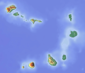
Monte Curral (Portuguese meaning "ranch”), is a small hill in the interior of the island of Sal in Cape Verde east of the center of the island capital Espargos. The mountain is of volcanic origin and features mainly eroded volcanic caldeira. Its elevation is 109 meters, some incorrectly has it at 107 meters. It is also the highest point in the much of Espargos.
Neighborhoods bordering the mountain are Pretória in the east, the Bairro Novo section, Morro Curral in the south and the City Center in the west, much of the mountain is in Morro Curral and its boundaries encircles at the urban limits of the north. Nearby is the Espargos Center Elementary School near the foot of the mountain.
The mountain features the most of all, an air control tower for Amílcar Cabral International Airport and that section forms a part of the airport property cut off for nearly a kilometer with the rest of the airport. One of a few of these founded in African and could be the only one in the western part of West Africa. It is also a communications tower which is used for radio and television and signals throughout the island, it is also used for phones. One of these is Record Cabo Verde which is on channel 37 for all of Sal along with BOOM and Zap TVs which were installed in the late 2000s. The facilities are connected by a single road with Morro Curral, the southern portion until 1950 was used for ranching.
At the control tower, one of its employees was Lúcio Antunes who later became a football manager, his first club was Académica do Sal from 2009 to 2010.
Before Espargos was founded in the late 1940s, the slopes were used as a cattle ranch. Morro Curral was used as a ranch probably in the 16th and the 17th centuries and from around the 19th century to after Espargos was founded around the 1950s. Hence its etymology of the neighborhood and mountain name.
After Espargos was founded, an air control tower would be built at the summit of the mountain, radio transmitters were added in the 1970s, television in the late 1990s and cell phone usage around the early 2000s.
A built-up area appeared in the southwestern portion in the 1950s, then spread east in the late 1960s, much of it became concentrated in the 1990s and became surrounded around the 2000s. In the outer parts of the foot of the mountain, housing developments, complexes and some other buildings were built.
...
Wikipedia

