Monte António Gomes
| Monte António Gomes | |
|---|---|
|
|
|
| Highest point | |
| Elevation | 362 m (1,188 ft) |
| Listing | List of mountains in Cape Verde |
| Coordinates | 16°53′24″N 24°55′46″W / 16.89°N 24.9294°WCoordinates: 16°53′24″N 24°55′46″W / 16.89°N 24.9294°W |
| Geography | |
| Location | northeastern São Vicente between Salamansa and Baía das Gatas |
| Geology | |
| Age of rock | Miocene and Pliocene |
| Mountain type | Stratovolcano |
| Type of rock | basalt, basanite |
| Climbing | |
| Easiest route | climb |
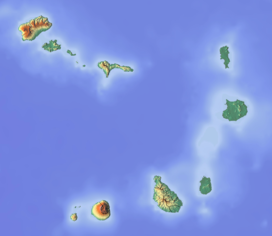
Monte António Gomes is a mountain located in the northeastern part of the island of São Vicente, Cape Verde 4 km from the capital Mindelo and mostly forms a part of the northernmost portion of Monte Verde, it does not belong to its nearby natural part but borders it. Its elevation is 362 meters taller than any summits north of the island capital Mindelo and forming the top ten or twenty small summits of the island. The mountain belongs to the settlement area of Baía das Gatas which includes its summit, the western part is in the village area of Salamansa.
The Mindelo-Baía das Gatas Road (EN2-ST02) runs in the northwest portion and northeast and east what was a small road, today it is EN2-SV03 connecting with Calhau opened around 2014.
The mountain is of volcanic origin and is made up of what was a small volcanic crater that was a subsidiary vent hundreds of thousands of years ago.
East of the small mountain is a small hamlet known as Norte da Baia (as there is another to the south, it is commonly as António Gomes in which it gives its name to) belonging to Baía das Gatas, northeast is Salamansa's cemetery, northeast of the foot of the mountain is the reforested area of Baía das Gatas.
Grasslands and shrubs dominate the mountain area, an endangered flowering plant Limonium jovibarba are founded, in areas more than 50 meters of elevation.
Its geology forms a part of the Monte Verde rock formation which extends to the peninsula's area.
During the Middle Ice Age, its elevation was about 500 meters, up to about 4000 BC, the elevation was at 400 meters.
Panoramics are offered including many parts of the island including the north, the east and west. Also almost all of the south of the nearby island of Santo Antão can be seen.
...
Wikipedia

